Area Overview for Borough & Bankside Ward
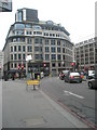
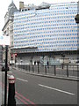
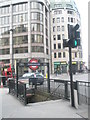
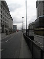
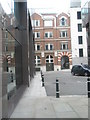
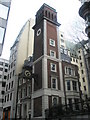
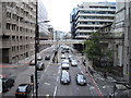
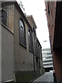
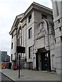
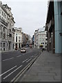
Photos of Borough & Bankside Ward


Area Information
Borough & Bankside Ward sits on the south bank of the Thames River, positioned between Blackfriars and London Bridge within the London Borough of Southwark. This electoral ward covers just 1.2 km² and holds a population of 1,284 residents according to available records. Although outside data suggests a wider population of 9,013 for the broader neighbourhood, this specific ward is a compact, densely populated district. The Bankside district has deep historical roots as one of England's oldest settlements. Originally serving as a strategic military base, the area later gained fame for theatres and entertainment venues during the early modern period. You are entering a location where history meets modern urban living. The ward is administratively defined to return three councillors to Southwark London Borough Council for the 2018 elections and onwards. Living here means utilisation of a space that is extremely small relative to its number of inhabitants. The area functions as an integral part of the Borough and London Bridge neighbourhood cluster. Understanding the scale of this ward is essential for anyone considering moving to Borough & Bankside Ward. The proximity to major landmarks and its specific designation as a unitary ward shape the daily experience for every resident.
- Area Type
- District Borough Unitary Ward
- Area Size
- 1.2 km²
- Population
- 1284
- Population Density
- 1073 people/km²
Demographics
The community within Borough & Bankside Ward displays a distinctively older demographic profile. The median age for residents is 70 years old, indicating a neighbourhood dominated by senior citizens. You will find that the most common age range is simply recorded as 'Total', meaning specific breakdowns by smaller bands are not detailed in the current dataset. This suggests a quiet environment suited to retirement living rather than young families or students. Home ownership stands at 25% within the ward. This figure implies that three quarters of households are renting or possessing other forms of tenure. With a population density of 1,073 people per km², living in Borough & Bankside Ward involves close proximity to neighbours. The ward constitutes a single electoral division that has been active since the 2018 local elections. While the area is steeped in history, the current social structure is heavily weighted towards an older demographic. You should expect a settled community where the majority of residents are over the age of retirement. The breakdown of household composition and predominant ethnic groups is recorded as 'total' in the available data, preventing a specific analysis of diversity levels. Similarly, religion statistics are not itemised. Despite these generalisations, the fixed nature of the occupier profile remains clear. The combination of a median age of 70 and low ownership rates paints a picture of a transient yet elderly population. Understanding these demographics is vital if you are planning to integrate into the Borough & Bankside Ward lifestyle.
Household Size
Accommodation Type
Tenure
Ethnic Group
Religion
Household Composition
Age
Household Deprivation
NS-SEC
Explore more demographic insights in this area
Go to Demographics tabPlanning
Planning Constraints
- Flood RiskPremium
- Ramsar Wetland SitesPremium
- Area of Outstanding Natural BeautyPremium
- Protected Nature ReservePremium
- Protected WoodlandPremium
- Crime RiskPremium