Area Overview for Blendon & Penhill Ward
Photos of Blendon & Penhill Ward
Area Information
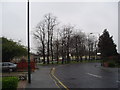
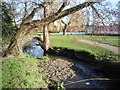
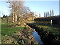
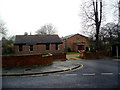
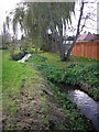
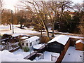
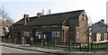
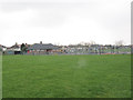
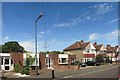
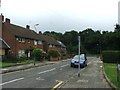
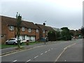
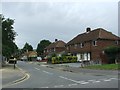
Living in Blendon & Penhill Ward means residing in a compact residential district within southeast London. This electoral ward covers a modest 3.4 square kilometres, yet it houses 4,715 residents. The area sits between Bexleyheath and Sidcup, positioning you squarely within the London Borough of Bexley. Administratively, the ward has returned three councillors to the local council since the 1978 elections, establishing a long-standing governance structure. The local heart beats along the western stretch of Blendon Road, where a small row of shops serves the immediate neighbours. Historically, the land belonged to the Bladindon family, with Blendon Hall standing since 1763 before being demolished for suburban housing in 1929. Today, the landscape is defined by middle-class residential streets rather than grand estates. You are bordering several other distinct centres, including Albany Park, Blackfen, and Welling. The ward contains a mix of backgrounds and neighbourhoods, creating a cohesive community focus centred on Blendon itself. For those seeking a defined local identity, this ward offers a clear footprint without the sprawl of larger outer London districts.
- Area Type
- District Borough Unitary Ward
- Area Size
- 3.4 km²
- Population
- 4715
- Population Density
- 1397 people/km²
Demographics
The community inside Blendon & Penhill Ward reflects a settled population with a median age of 70 years. This demographic profile indicates a neighbourhood where life moves at a measured pace, dominated by older residents. Almost ninety per cent of the population falls into the total age bracket, signalling that the ward attracts those looking to settle rather than move frequently. Home ownership is exceptionally high, with 87 per cent of households holding the deed to their property. This statistic confirms that rental properties are relatively rare compared to terraced or detached homes. The area lacks significant divisions by predominant ethnic group or religious affiliation, suggesting a community integrated over many decades. Household composition data highlights a total mix of family types, yet the high ownership rate implies multi-generational living or settled families staying long-term. You will find that the population density reaches 1,397 people per square kilometre, meaning the streets feel lived-in but not overcrowded. This density supports local amenities without creating the congestion common in denser boroughs. Living here offers a stable environment where neighbours are likely to have known one another for generations.
Household Size
Accommodation Type
Tenure
Ethnic Group
Religion
Household Composition
Age
Household Deprivation
NS-SEC
Explore more demographic insights in this area
Go to Demographics tabPlanning
Planning Constraints
- Flood RiskPremium
- Ramsar Wetland SitesPremium
- Area of Outstanding Natural BeautyPremium
- Protected Nature ReservePremium
- Protected WoodlandPremium
- Crime RiskPremium