Area Overview for Blackheath Ward
Photos of Blackheath Ward
Area Information
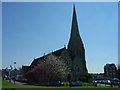
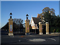
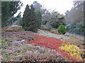
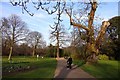
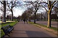
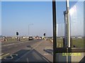
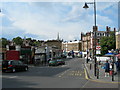
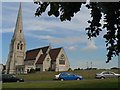
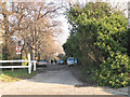
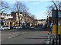
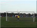
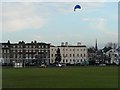
Blackheath Ward occupies a distinct strip in southeast London, straddling the Royal Borough of Greenwich and the London Borough of Lewisham. This ward covers an area of just 2.4 km², yet it holds a population of 2,903 people. Living in Blackheath Ward means residing in a suburban village setting characterised by refined Georgian and Victorian architecture. The area is centred on an open heathland common of about 270 acres, which borders the larger Greenwich Park to the north. This unique layout separates the residential zones from significant recreational spaces. Development in the ward began as a village in the early 19th century, evolving from historic military muster grounds along the A2 to a residential hub with formal parish boundaries established in 1854. You will find large houses, including the colonnaded structures of The Paragon and the older Span developments. The village centre around Tranquil Vale provides essential amenities such as shops, banks, and assembly rooms. Blackheath Halls, built in 1895, remains a focal point for local entertainment. The location offers panoramic views toward Kent and Surrey, blending historical significance with modern lifestyle convenience. You are effectively living in a conservation area where preservation efforts by the Blackheath Preservation Trust maintain the character of the housing stock. The ward includes notable landmarks like Morden College and Ranger's House, adding to the historic depth of the neighbourhood.
- Area Type
- District Borough Unitary Ward
- Area Size
- 2.4 km²
- Population
- 2903
- Population Density
- 1190 people/km²
Demographics
The community within Blackheath Ward presents a specific age profile and household structure. The median age for residents is 70 years old, indicating a population significantly older than the national average. The most common age range covers the total demographic, reflecting this skewed age distribution. This age profile influences how services are used and how the community interacts daily. Home ownership stands at 40%, meaning a substantial portion of residents rent their homes rather than own them outright. This includes a mix of owner-occupied properties and private or social rentals. The ward contains a total number of households, with accommodation types ranging from single-family homes to flats within the larger properties. While specific data on ethnic groups, religion, and detailed household composition percentages are not provided, the overall picture suggests a settled, mature community. The high median age implies fewer young families moving in for school runs, though the presence of Morden College and Morden Heights Primary School nearby may still attract younger households. With only 2,903 residents across 2.4 km², the population density reaches 1,190 people per km², creating a closely knit environment without the overwhelming scale of central London. Living here means joining a community where neighbours likely know each other for several decades.
Household Size
Accommodation Type
Tenure
Ethnic Group
Religion
Household Composition
Age
Household Deprivation
NS-SEC
Explore more demographic insights in this area
Go to Demographics tabPlanning
Planning Constraints
- Flood RiskPremium
- Ramsar Wetland SitesPremium
- Area of Outstanding Natural BeautyPremium
- Protected Nature ReservePremium
- Protected WoodlandPremium
- Crime RiskPremium