Area Overview for Bishopsgate Ward
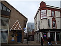
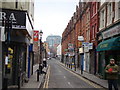
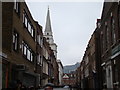
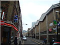
Photos of Bishopsgate Ward

Area Information
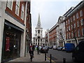
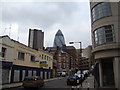
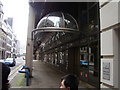
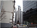
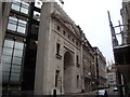
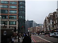
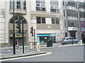
Living in Bishopsgate Ward offers a distinctly urban experience centred on the dense financial core of the City of London. This electoral ward encompasses 25.3 hectares and features a unique irregular shape often described as three distinct lumps, with Bishopsgate Street acting as the central spine. The area is defined by two main sections: Bishopsgate Within, located inside the historic city wall, and Bishopsgate Without, which extends outside. Daily life here reflects a chasm-like atmosphere dominated by vast glass high-rise office buildings along Bishopsgate's eastern side. Much of Bishopsgate Without lies under the canopy of Liverpool Street Station, a major transport hub that opened in 1874. Historically, this thoroughfare served as a key artery linking London Bridge to Ermine Street, a route established in Roman times. Today, the street plan retains its medieval and Tudor origins while functioning as a critical north-south linkage to the Shoreditch suburb. You will find yourself navigating Houndsditch Street and the historic Leadenhall area, where the remnants of the old Roman Bishopsgate gate stand as a witness to the ward's long history. This setting provides a backdrop of significant historical weight juxtaposed against modern commercial intensity, making it a specific choice for those seeking a life deeply intertwined with the City's history and commerce.
- Area Type
- District Borough Unitary Ward
- Area Size
- 25.3 hectares
- Population
- Not available
- Population Density
- Not available
Demographics
The community within Bishopsgate Ward is characterised by high density and significant diversity, typical of its central London location. Households in the ward number approximately 700, reflecting a population that relies heavily on walking, cycling, or public transport to navigate the area. The demographic profile shows a mix of household types, with a notable proportion of single-person homes indicating a housing stock suited to professionals and singles. Despite the high concentration of residents in such a small 25.3-hectare space, deprivation levels remain low. Just one out of roughly 1,200 residents falls into the most deprived category, suggesting that quality of life for the vast majority is not hindered by economic disadvantage. This statistical reality supports a neighbourhood where daily commerce flows without significant socioeconomic friction. The presence of roughly 700 households confirms that the area supports a substantial residential population alongside its commercial functions. While specific data on age distribution or income brackets is not detailed in the current records, the household count offers a clear picture of the area's residential scale. You can expect to live in an environment where the sheer volume of households creates a continuous sense of activity, even if the specific age breakdown of these 700 homes remains unquantified. The low deprivation score reinforces the idea that residents here generally experience a standard of living aligned with the wider City of London average.
Household Size
Accommodation Type
Tenure
Ethnic Group
Religion
Household Composition
Age
Household Deprivation
NS-SEC
Explore more demographic insights in this area
Go to Demographics tabPlanning
Planning Constraints
- Flood RiskPremium
- Ramsar Wetland SitesPremium
- Area of Outstanding Natural BeautyPremium
- Protected Nature ReservePremium
- Protected WoodlandPremium
- Crime RiskPremium