Area Overview for Berrylands Ward
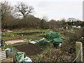
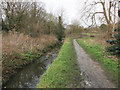
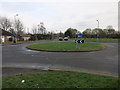
Photos of Berrylands Ward


Area Information
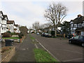
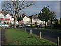
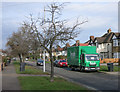
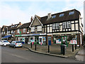
Berrylands Ward is a compact district within the London Borough of Sutton, covering just 1.2 square kilometres. You will find 1,546 residents living across this relatively small footprint, creating a population density of 1,272 people per square kilometre. This concentration suggests a neighbourhood of mostly terraced or semi-detached homes rather than large estates. Living in Berrylands Ward means navigating a closely knit environment where daily life revolves around immediate local amenities rather than expansive green spaces or sprawling roads. The area functions as a established residential unit within Greater London, offering a sense of containment that some buyers prefer over the unpredictability of rapidly expanding suburbs. You can expect a stable, if slightly intense, daily rhythm due to the sheer number of people occupying such limited ground. The ward does not boast major commercial hubs or extensive parks within its boundaries, so your morning and evening routines often depend on facilities located just outside these specific limits. It is a traditional working-class ward that has maintained its character despite decades of urban development surrounding it.
- Area Type
- District Borough Unitary Ward
- Area Size
- 1.2 km²
- Population
- 1546
- Population Density
- 1272 people/km²
Demographics
The community profile of Berrylands Ward is dominated by a much older generation. The median age for residents is 70 years, a figure that significantly diverges from the national and London averages. You are looking at a neighbourhood where the vast majority of adults are past retirement age, and the most common age range reflects this senior demographic. With 75% of households reporting ownership, you will find that most families have lived in their properties for many years, often passing them down through generations. This high level of ownership contrasts sharply with areas where short-term rentals are common. The accommodation stock largely consists of standard domestic buildings typical of post-war developments in Sutton. While specific breakdowns of household composition and predominant ethnic groups are not detailed in the available records, the overall picture points to a settled, long-standing population. The area feels anchored by retirees who have decided to stay rather than move to coastal retirement villages or the countryside. This stability reduces turnover, meaning your neighbours are likely to remain in place for the duration of your stay.
Household Size
Accommodation Type
Tenure
Ethnic Group
Religion
Household Composition
Age
Household Deprivation
NS-SEC
Explore more demographic insights in this area
Go to Demographics tabPlanning
Planning Constraints
- Flood RiskPremium
- Ramsar Wetland SitesPremium
- Area of Outstanding Natural BeautyPremium
- Protected Nature ReservePremium
- Protected WoodlandPremium
- Crime RiskPremium