Area Overview for Bassishaw Ward
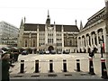
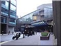
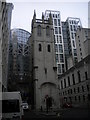
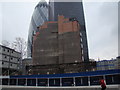
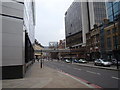
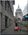
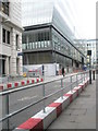
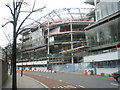
Photos of Bassishaw Ward
Area Information
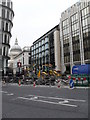
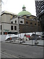
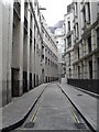
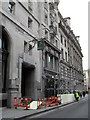
Living in Bassishaw Ward offers a very specific urban experience within the City of London. This district borough unitary ward occupies a small footprint of just 10.7 hectares, presenting a densely packed environment typical of the historic heart of England. You are purchasing into a location that is integral to the national financial and legal infrastructure, rather than seeking out spacious suburbs. The area defines itself through extreme density and central location rather than green space or quiet streets. Prospective buyers must value proximity to major business hubs over home size or garden rooms. Daily life here revolves around the immediate access to employment centres that dominate the wider London landscape. The character of Bassishaw Ward is shaped entirely by its location and historical significance as a ward within the City of London. There are no major parks or rural fringes in this 10.7-hectare zone. Instead, you will find a concentration of historic buildings and street-level commerce that has served the capital for centuries. The sense of place comes from the surrounding architecture and the constant bustle of the surrounding ward boundary. You should expect a living environment that prioritises convenience over privacy and service access over space. If your priority is being at the centre of everything, this ward delivers that promise without compromise.
- Area Type
- District Borough Unitary Ward
- Area Size
- 10.7 hectares
- Population
- Not available
- Population Density
- Not available
Demographics
The community profile in Bassishaw Ward reflects the nature of the City of London itself. You are drawing a resident population with a median age of 70 years. This figure indicates a significant proportion of older residents occupy homes in the ward. The age range data is recorded as 'Total', suggesting a broad distribution where older demographics are most visible in current statistics. Consequently, the street scene will often include pensioners and individuals seeking quieter residential pockets within the busy centre. Home ownership stands at 53%, meaning that slightly more than half of the residents own the property where they live. The remaining 47% reside in rented accommodation. This split creates a market where leasehold transactions and buy-to-let landlords operate alongside private owners. Household composition data is categorised simply as 'total', offering no breakdown of families versus singles, but the high median age suggests large families are less prevalent. Accommodation types are listed as 'total', implying a mix of flats and terraced housing common in London wards. While specific ethnic and religious groupings are listed as 'total' in the provided records, the ward sits in the most diverse municipality in England. You should anticipate a multicultural population wherever you look in the City. The high proportion of owner-occupiers contrasts with the typically transient workforce of nearby business districts.
Household Size
Accommodation Type
Tenure
Ethnic Group
Religion
Household Composition
Age
Household Deprivation
NS-SEC
Explore more demographic insights in this area
Go to Demographics tabPlanning
Planning Constraints
- Flood RiskPremium
- Ramsar Wetland SitesPremium
- Area of Outstanding Natural BeautyPremium
- Protected Nature ReservePremium
- Protected WoodlandPremium