Area Overview for Wivenhoe Ward
Photos of Wivenhoe Ward


Area Information
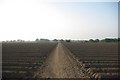
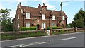
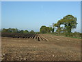
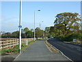
Wivenhoe Ward is a district borough unitary ward in Essex, situated approximately 3.2 kilometres south-east of Colchester. The area covers 7.5 square kilometres and sits on the left bank of the tidal River Colne estuary. You will find that Wivenhoe Ward has a distinct historical character shaped by its past as a maritime port and shipbuilding hub. The town centre features the historic Church of St. Mary the Virgin, which dates back to 1254, and Wivenhoe House, a notable landmark built in 1759. Today, living in Wivenhoe Ward offers a blend of historical significance and modern convenience. The area falls under the jurisdiction of the City of Colchester district and forms part of the wider town and civil parish of Wivenhoe. While the location is defined by its coordinates around 51.875968, 0.946456, the practical reality for residents is a walkable community connected by local roads and railway lines. The ward remains a residential district where the daily rhythm centres on the proximity to the river and the town's historic core. Your experience here will be defined by this specific geography and the established community that has inhabited these boundaries since the Domesday Book.
- Area Type
- District Borough Unitary Ward
- Area Size
- 7.5 km²
- Population
- 1719
- Population Density
- 230 people/km²
Demographics
The community in Wivenhoe Ward is notably older than the national average. The median age for residents is 70 years, indicating a population dominated by older adults. You are more likely to encounter elderly residents or families with mature members than young professionals in their twenties or thirties. The ward consists of 1,719 people, resulting in a population density of 230 people per square kilometre. Home ownership is extremely high in this area, with 78% of residents owning their property outright. This figure suggests a neighbourhood where long-term stability is the norm rather than the exception. The data does not provide a specific breakdown of household types, such as single-person versus multi-generational homes, but the age profile strongly implies a prevalence of empty nesters or retirees. There is no information regarding specific ethnic demographics or religious composition in the available records. For those considering living in Wivenhoe Ward, you should expect an environment tailored to the needs of an older demographic, with services and social activities likely reflecting this concentration.
Household Size
Accommodation Type
Tenure
Ethnic Group
Religion
Household Composition
Age
Household Deprivation
NS-SEC
Explore more demographic insights in this area
Go to Demographics tabPlanning
Planning Constraints
- Flood RiskPremium
- Ramsar Wetland SitesPremium
- Area of Outstanding Natural BeautyPremium
- Protected Nature ReservePremium
- Protected WoodlandPremium
- Crime RiskPremium