Area Overview for Wisbech South Ward
Photos of Wisbech South Ward


Area Information
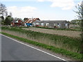
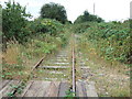
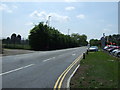
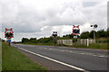
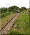
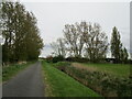
Living in Wisbech South Ward offers a specific experience within the Fenland District. This district borough unitary ward covers 6.5 km² of land near the market town of Wisbech. It sits on either side of the tidal River Nene, placing you just five miles south of Lincolnshire and bordering Norfolk. The history here is tied to the town's former prosperity as Cambridgeshire's only gateway to the sea. Although river works impeded navigation after 1852, the location remains defined by its position around the market town. Coordinates point to approximately 52.664°N 0.160°E, confirming its fixed location in the far north-east of Cambridgeshire. The ward functions as a specific administrative division within the Eastern Region of England. Residents navigate a landscape where past industrial significance meets current residential use. The area encompasses part of the market town and surrounding zones. This geography creates a community bound by proximity to the River Nene port area. Understanding this context helps you grasp why the ward has a distinct character compared to inland districts. You are entering an area where local governance operates under Fenland District Council. The physical boundaries include both built-up zones and the surrounding areas along the river.
- Area Type
- District Borough Unitary Ward
- Area Size
- 6.5 km²
- Population
- Not available
- Population Density
- Not available
Demographics
The community profile in Wisbech South Ward points to a predominantly older population. The median age stands at 70 years, indicating a significant shift away from younger families. You will find a neighbourhood where residents have lived through multiple generations or have settled later in life. Most household composition data relates to the total population, reflecting this established status. Home ownership levels sit at 51%, meaning just over half of the residents buy their homes outright. This threshold suggests a balanced market where neither renting nor buying dominates the tableau completely. The ward lacks specific data on predominant ethnic groups, religious affiliations, or detailed age range breakdowns beyond the median figure. Despite this, the 70-year median age defines the social fabric. You need to consider how services cater to this demographic when evaluating daily life. The 51% ownership rate implies that nearly half of the residents rely on private tenants or the state housing system. This dynamic influences local shops, community centres, and social clubs. The high median age suggests lower energy consumption for travel but higher demand for healthcare facilities. Understanding this age profile is essential for anyone seeking to move into this specific ward.
Household Size
Accommodation Type
Tenure
Ethnic Group
Religion
Household Composition
Age
Household Deprivation
NS-SEC
Explore more demographic insights in this area
Go to Demographics tabPlanning
Planning Constraints
- Flood RiskPremium
- Ramsar Wetland SitesPremium
- Area of Outstanding Natural BeautyPremium
- Protected Nature ReservePremium
- Protected WoodlandPremium
- Crime RiskPremium