Area Overview for Whittlesford
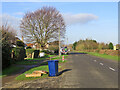
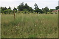
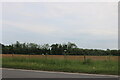
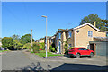
Photos of Whittlesford
Area Information
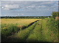
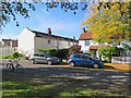
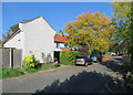
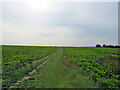
Whittlesford is a compact built-up area in England, covering 81.6 hectares and serving as a practical, low-density settlement. Its population, while not explicitly quantified, skews older, with a median age of 70, suggesting a community of long-term residents. The area’s character is defined by its proximity to essential services and transport links, making it accessible for daily life. Residents benefit from nearby railway stations, including Whittlesford Parkway and Shelford, which connect to Cambridge and beyond. Retail options are varied, with local stores like M&S Whittlesford Cambridge BP and Spar within reach. For families, the William Westley Church of England VC Primary School offers a solid foundation for education. The area’s blend of practicality and connectivity suits those prioritising convenience over urban intensity, with a quieter, more settled rhythm of life.
- Area Type
- Built Up Area 250
- Area Size
- 81.6 hectares
- Population
- Not available
- Population Density
- Not available
Residents of Whittlesford have access to a range of local amenities within practical reach. Retail options include M&S Whittlesford Cambridge BP, Spar, and Co-op Sawston, offering everyday shopping needs. The area’s railway stations, such as Whittlesford Parkway and Great Chesterford, provide easy access to broader networks, facilitating travel to nearby towns and cities. While the data does not mention parks or leisure facilities explicitly, the presence of multiple retail and transport hubs suggests a community focused on practicality and accessibility. The combination of local shops and efficient transport links ensures residents can meet daily needs without lengthy commutes, contributing to a convenient, low-stress lifestyle.
Amenities
Schools
The William Westley Church of England VC Primary School is the only school explicitly listed near Whittlesford, offering primary education with a 'good' Ofsted rating. This single school suggests limited options for families requiring secondary education, which may necessitate commuting to nearby towns. The presence of a well-rated primary school is a positive for families with young children, but the absence of secondary schools or alternative educational providers could be a consideration for those planning long-term residency. Parents should factor in the need for additional schooling resources beyond the primary level when evaluating the area.
| Rank | A + A* % | School | Type | Entry gender | Ages |
|---|---|---|---|---|---|
| 1 | N/A | William Westley Church of England VC Primary School | primary | N/A | N/A |
Explore more schools in this area
Go to Schools tabDemographics
Whittlesford’s population has a median age of 70, indicating a predominantly older demographic. This suggests a community where long-term residents predominate, with fewer younger families or professionals. Home ownership rates are strong, at 72%, reflecting a stable housing market where most residents live in properties they own. The data does not specify household composition or accommodation types, but the high home ownership rate implies a mix of family homes and single-occupancy properties. The area’s demographic profile is less diverse in terms of ethnicity and religion, with no specific figures provided. While this may contribute to a cohesive, familiar social fabric, it also means the community is less representative of broader societal diversity.
Household Size
Accommodation Type
Tenure
Ethnic Group
Religion
Household Composition
Age
Household Deprivation
NS-SEC
Explore more demographic insights in this area
Go to Demographics tabPlanning
Planning Constraints
- Crime RiskLocked