Area Overview for Whittlesey Lattersey Ward
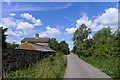
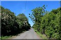
Photos of Whittlesey Lattersey Ward
Area Information
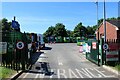
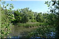
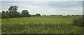
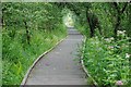
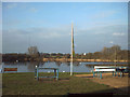
Living in Whittlesey Lattersey Ward offers a distinct set of advantages due to its compact size and strategic location. This electoral ward is situated within the Fenland district of Cambridgeshire, sitting approximately six miles east of Peterborough. The area is defined by its proximity to the River Nene to the north and Whittlesey Dyke to the south. Spanning just over one and a half square miles, this ward functioned as a small community unit before the 2023 local government reorganisation, which expanded the boundaries of Whittlesey to integrate Lattersey more fully with the larger town. You will find the modern A605 cuts through the vicinity, following the historic route of the Roman Fen Causeway that links Peterborough and March. This transport link connects you to National Cycle Network Route 63, facilitating access to wider Cambridgeshire. The neighbourhood is bordered by open spaces, including the Lattersey Nature Reserve to the south-east, providing immediate access to green areas. Your daily life here benefits from a clear physical layout and direct routes to key employment hubs. The ward operates under the unitary authority structure, managing its affairs within the framework set by Fenland District Council and Cambridgeshire County Council.
- Area Type
- District Borough Unitary Ward
- Area Size
- 1.2 km²
- Population
- Not available
- Population Density
- Not available
Demographics
The community living in Whittlesey Lattersey Ward reflects a mature and stable population. The median age across the ward stands at seventy years, significantly higher than the national average. This demographic profile suggests that the area is primarily suited for retirees or those nearing the end of their working lives. Home ownership is prevalent in this neighbourhood, with sixty-four per cent of households owning their homes outright or with a mortgage. This statistic indicates a settled resident base rather than a transient rental population. The demographic data does not reveal specific breakdowns by religion, predominant ethnic group, or detailed household composition ratios in the current records. Consequently, you should expect a traditional demographic makeup typical of rural Cambridgeshire wards. The absence of younger age groups implies fewer families with young children in this specific ward compared to the broader Whittlesey town. You are looking at an area with a quiet atmosphere driven by older residents. The high proportion of owner-occupiers further reinforces the stability of the community. There are no indicators of significant population turnover or large student communities within these boundaries.
Household Size
Accommodation Type
Tenure
Ethnic Group
Religion
Household Composition
Age
Household Deprivation
NS-SEC
Explore more demographic insights in this area
Go to Demographics tabPlanning
Planning Constraints
- Flood RiskPremium
- Ramsar Wetland SitesPremium
- Area of Outstanding Natural BeautyPremium
- Protected Nature ReservePremium
- Protected WoodlandPremium
- Crime RiskPremium