Area Overview for Whinburgh and Westfield
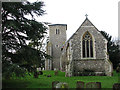
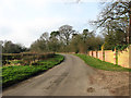
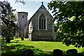
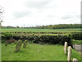
Photos of Whinburgh and Westfield
Area Information
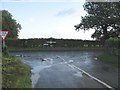
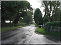
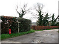
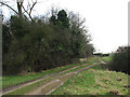
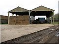
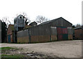
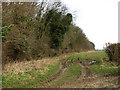
Living in Whinburgh and Westfield offers a distinct rural experience within a parish spanning 7.6 square kilometres. This civil parish sits quietly away from the immediate noise of larger urban centres, providing a setting where daily life revolves around the pace of the countryside rather than city traffic. You will find that homes in Whinburgh and Westfield cater primarily to those seeking space and tranquillity. The area does not boast high-rise blocks or dense city streets; instead, property options typically reflect a residential character suited to families or couples wishing for a lower-key lifestyle. Your day-to-day routine here will likely involve local shops and parks within easy reach, supporting a self-contained community feel. The village nature of the parish means you are surrounded by neighbours who have lived in Whinburgh and Westfield for generations. There is no traffic congestion to disrupt your morning commute to the main roads that connect to the rest of the region. You can walk through the parish without feeling rushed, appreciating the open green spaces that define the landscape. This environment suits anyone who values privacy and a connection to the outdoors over the bustle of metropolitan living.
- Area Type
- Parish
- Area Size
- 7.6 km²
- Population
- Not available
- Population Density
- Not available
Demographics
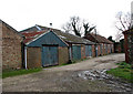
The community in Whinburgh and Westfield is notably older than the national average. The median age across the parish is 70, indicating a population dominated by retirees and long-term residents rather than young professionals with children. This demographic profile explains the quiet atmosphere you will encounter during the week. While specific breakdowns for age ranges limited the most common age group to the total population, the high median age confirms a village built for retirement living. Home ownership is the prevailing norm in Whinburgh and Westfield. An impressive 81 per cent of households own their homes outright or with a mortgage. This high rate of ownership suggests a stable population with deep roots in the local area. You are unlikely to encounter a high turnover of short-term tenants or frequent move-ins, as most people tend to settle down for the long haul. The accommodation types reflect this settled lifestyle, offering traditional housing stock rather than modern high-density developments. Furthermore, the parish does not have recorded data on predominant ethnic groups or religious compositions, which is typical for smaller, established rural parishes where the community makeup has remained consistent for decades.
Household Size
Accommodation Type
Tenure
Ethnic Group
Religion
Household Composition
Age
Household Deprivation
NS-SEC
Explore more demographic insights in this area
Go to Demographics tabPlanning
Planning Constraints
- Flood RiskPremium
- Ramsar Wetland SitesPremium
- Area of Outstanding Natural BeautyPremium
- Protected Nature ReservePremium
- Protected WoodlandPremium
- Crime RiskPremium