Area Overview for Weston & Sandon Ward
Photos of Weston & Sandon Ward

Area Information
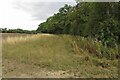
Living in Weston & Sandon Ward offers a distinct experience defined by its scale and mature character. The ward covers an area of 61.5 square kilometres, providing a broad canvas for homes and local life. You will find a community where daily routines are shaped by a resident base that has settled deeply into their surroundings. The demographic makeup points to a retirement-focused environment, which influences the pace and energy of the neighbourhood. This is not a high-density urban zone; rather, it is a district where space and established communities take precedence. When you consider homes in Weston & Sandon Ward, you are looking at an area designed for stability. The physical footprint allows for a spread-out lifestyle, ideal for those who value quiet and established local ties. Your view of daily life here centres on consistency and a lack of rapid change. The ward stands as a significant unitary borough district within England, reflecting its established status. Prospective buyers should view this as a place for long-term residence. The sheer size of the ward accommodates various pockets of activity while maintaining a cohesive identity. You move through an area where the built environment has served its purpose for decades. This context matters when you weigh your options for a new home.
- Area Type
- District Borough Unitary Ward
- Area Size
- 61.5 km²
- Population
- Not available
- Population Density
- Not available
Demographics
The community profile of Weston & Sandon Ward is defined by age and ownership stability. The median age sits at 70, indicating that the population is significantly older than the national average. This age profile reshapes your understanding of the local community dynamics. Most residents fall into the older age bracket, which influences local services and social activities. You will encounter a neighbourhood where generations have remained in their homes over many years. A striking 69 per cent of the population owns their homes outright or with a mortgage. This high ownership rate suggests deep community roots rather than a transient rental market. The remaining residents likely include those buying into the area for retirement or specific housing needs. Accommodation types reflect this stability, with a prevalence of properties suited to established households. The ward does not display obvious gaps in ethnicity or religious data, suggesting a homogenous demographic structure typical of retirement zones. As you assess living in Weston & Sandon Ward, you must consider how this age distribution affects the local environment. Services and amenities will have been built to serve an older demographic. The community feel is one of permanence. People are likely to know their neighbours for decades. This creates a supportive network, though it may mean slower adaptation to new faces or families arriving from elsewhere.
Household Size
Accommodation Type
Tenure
Ethnic Group
Religion
Household Composition
Age
Household Deprivation
NS-SEC
Explore more demographic insights in this area
Go to Demographics tabPlanning
Planning Constraints
- Flood RiskPremium
- Ramsar Wetland SitesPremium
- Area of Outstanding Natural BeautyPremium
- Protected Nature ReservePremium
- Protected WoodlandPremium
- Crime RiskPremium