Area Overview for Westley Waterless
Photos of Westley Waterless
Area Information
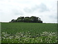
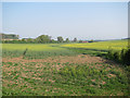
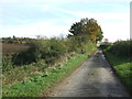
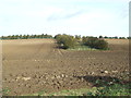
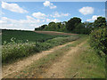
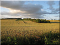
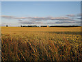
Living in Westley Waterless offers a distinctly rural experience within south-eastern Cambridgeshire. This small village covers just 4.9 km², functioning as a cohesive community rather than a sprawling settlement. The parish extends approximately five miles south-west from Newmarket, bordering the ancient Icknield Way, which now forms part of the A1304. Your daily life will revolve around the village hall, which serves as the primary focal point for local activities ranging from parties to cycling clubs. The former White Horse pub closed by 1976, signalling a shift away from a commercial centre toward a residential life. The area feels defined by its deep historical roots and pastoral character. The parish church of St Mary the Less stands as the principal landmark, dating substantially from the 13th century. You will find walking routes through the beautiful Suffolk and Cambridgeshire countryside surrounding the hamlet of Westley Bottom. This settlement is not a modern development but an established location with significant history. A leaden vessel filled with tools predating the Norman Conquest has been discovered at the site, and the Domesday Book recorded *Weslai* here thousands of years later. The name itself derives from "westerly meadow", reminding residents of its agricultural past. Today, the population is small and stable, ensuring that life here remains intimate and connected to the land rather than the city.
- Area Type
- Parish
- Area Size
- 4.9 km²
- Population
- Not available
- Population Density
- Not available
Demographics
The community in Westley Waterless is characterised by an older demographic profile. The median age for residents is 70 years old, indicating that the area is populated significantly by senior citizens. This age distribution suggests a neighbourhood where life often slows down, catering to those seeking retirement or a quiet country life rather than a bustling family hub. Correspondingly, the home ownership rate is exceptionally high at 77%, which aligns with the older population seeking stability and equity. Most households are owned outright or through mortgages typical of this age group rather than young families building a first home. Diversity metrics such as predominant ethnic group and religious affiliation are not detailed in current records, but the high degree of home ownership suggests a settled, long-term resident base. The population has fluctuated historically, peaking at 214 individuals in 1851 before settling to around 150 to 155 residents today. This reduction from the Victorian peak highlights the village's evolution from a larger agricultural centre to its current small-scale existence. You will find that the household composition reflects a changing family dynamic, with fewer young children and more empty nesters. The specific accommodation types vary, but the overwhelming sentiment is one of established residence. Living here means joining a community where property ownership is the norm and long-term ties to the land are common. The lack of newer developments reflects the parish's controlled growth and its focus on preserving its historical character.
Household Size
Accommodation Type
Tenure
Ethnic Group
Religion
Household Composition
Age
Household Deprivation
NS-SEC
Explore more demographic insights in this area
Go to Demographics tabPlanning
Planning Constraints
- Flood RiskPremium
- Ramsar Wetland SitesPremium
- Area of Outstanding Natural BeautyPremium
- Protected Nature ReservePremium
- Protected WoodlandPremium
- Crime RiskPremium