Area Overview for Westhall
Photos of Westhall
Area Information
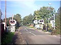
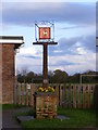
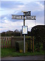
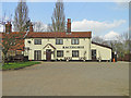
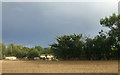
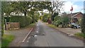
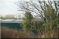
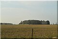
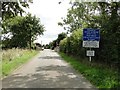
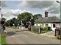
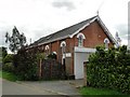
Living in Westhall offers a distinctly tranquil lifestyle centred around the rhythms of rural parish life. This civil parish sprawls across 9.4 square kilometres of land, providing a generous footprint for those seeking space and quiet. You will find yourself away from the noise of major urban centres, immersed instead in a setting defined by simplicity and openness. The area is not bustling with nightlife or large-scale commercial developments. Instead, daily life revolves around a slower pace where residents enjoy the benefits of a low-density environment. The community is tightly knit, characterised by long-term residents who have called this spot home for generations. The absence of heavy planning constraints means the physical layout remains relatively unchanged, preserving the traditional character of the neighbourhood. You can expect wide-open vistas rather than dense urban streets. This setting suits individuals and families who value privacy while maintaining access to surrounding green spaces. It is a place where time moves differently, far removed from the rapid pace of city living. For prospective buyers, understanding Westhall means recognising its identity as a peaceful settlement. The area does not compete for attention with flashy new amenities. Its appeal lies in its authenticity and lack of development pressure. Whether you are looking for a weekend retreat or a permanent residence, the parish delivers a consistent identity. You will experience a world where nature predominates and suburban sprawl is absent. This is a location for reflection and stability.
- Area Type
- Parish
- Area Size
- 9.4 km²
- Population
- Not available
- Population Density
- Not available
Demographics
The community in Westhall reflects a mature population with a clear demographic focus. The median age stands at 70 years, indicating that the vast majority of residents are senior citizens. This alignment with the most common age range suggests a neighbourhood primarily inhabited by older adults. You will encounter a population that has settled here for the long term rather than a transient group of commuters or students. Home ownership defines the local economy and social structure. Seventy-four per cent of residents own their homes outright or with a mortgage. This high level of ownership contrasts sharply with areas dominated by private renting. Instead, you will find families and retirees who have invested in local properties to stay. The accommodation types mirror this stability, suggesting a stock suited to long-term habitation rather than short-term letting. Demographic data highlights a uniform community profile. The total household composition shows little variation, pointing to a consistent way of life across the parish. You will not see significant shifts in family structures or transient populations moving through the area weekly. The predominant ethnic group and religious affiliations remain consistent with broader rural patterns, reflecting a traditionally homogenous population. This stability creates a predictable environment where neighbours know each other well. For those considering a move, the demographic picture is clear: this is a place for retirees and established residents seeking continuity.
Household Size
Accommodation Type
Tenure
Ethnic Group
Religion
Household Composition
Age
Household Deprivation
NS-SEC
Explore more demographic insights in this area
Go to Demographics tabPlanning
Planning Constraints
- Flood RiskPremium
- Ramsar Wetland SitesPremium
- Area of Outstanding Natural BeautyPremium
- Protected Nature ReservePremium
- Protected WoodlandPremium
- Crime RiskPremium