Area Overview for West Hyde
Photos of West Hyde


Area Information
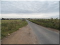
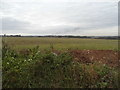
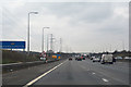
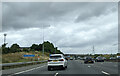
West Hyde is a compact built-up area in England, covering 29.6 hectares. Its population, while not explicitly stated, reflects a community shaped by its proximity to nearby towns and transport links. The area’s character is defined by its mix of residential properties and accessible amenities, making it a practical choice for those seeking a balance between convenience and a quieter lifestyle. With a median age of 70, the community leans towards older residents, suggesting a stable, long-established demographic. The area’s appeal lies in its practicality: nearby rail and metro stations, such as Gerrards Cross and Denham, connect residents to wider networks, while shops like Morrisons and M&S provide daily essentials. Safety is a key factor, with a crime risk score of 82, indicating a below-average risk and a generally secure environment. For buyers, West Hyde offers a straightforward, no-frills living experience, ideal for those prioritising ease of access to transport, retail, and a low-crime setting.
- Area Type
- Built Up Area 250
- Area Size
- 29.6 hectares
- Population
- Not available
- Population Density
- Not available
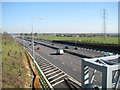
Living in West Hyde offers a practical lifestyle with essential amenities within reach. Retail options include Morrisons Daily, Budgens Rickmansworth, and M&S Chalfont, providing everyday shopping needs. The area’s transport links are a key feature, with rail stations like Denham Golf Club Railway Station and Denham Railway Station, plus metro stops such as Willow Lawn and Haste Hill, facilitating easy travel. For leisure, the proximity to RAF Northolt may offer unique opportunities, though recreational spaces are not explicitly detailed in the data. The mix of retail, transport, and nearby infrastructure ensures residents can access essentials without lengthy commutes. While the data does not specify parks or dining options, the presence of multiple retail and transport hubs suggests a functional, convenience-focused lifestyle.
Amenities
Schools
| Rank | School | Type | Entry gender | Ages |
|---|
Explore more schools in this area
Go to Schools tabDemographics
West Hyde’s population is predominantly older, with a median age of 70, reflecting a community where retirees and long-term residents form the majority. Home ownership is high, at 81%, suggesting a stable, owner-occupied demographic. This figure implies that most residents have long-term ties to the area, contributing to a sense of continuity. Household composition and accommodation types are not specified in detail, but the data highlights a total count across all categories, indicating diversity in living arrangements. The area’s ethnic and religious profiles are not quantified, but the absence of specific figures suggests no single group dominates. While deprivation data is not provided, the high home ownership rate and low crime risk hint at a community with relatively strong economic stability. However, the older age profile may mean fewer young families, which could influence local services and amenities.
Household Size
Accommodation Type
Tenure
Ethnic Group
Religion
Household Composition
Age
Household Deprivation
NS-SEC
Explore more demographic insights in this area
Go to Demographics tabPlanning
Planning Constraints
- Crime RiskPremium