Area Overview for Werrington Ward
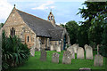
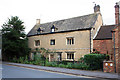
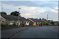
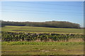
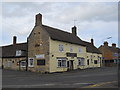
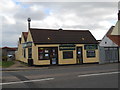
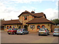
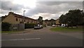
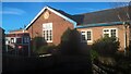
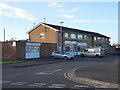
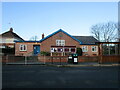
Church of St John the Baptist, Werrington in Werrington Ward
Church Street, Werrington in Werrington Ward
Salisbury Road, Werrington in Werrington Ward
Drain by the railway line in Werrington Ward
The Cock Inn, Werrington in Werrington Ward
Werrington Traditional Fish and Chips in Werrington Ward
The Crab and Winkle, Werrington in Werrington Ward
Danish Court, Werrington in Werrington Ward
Werrington Parish Village Centre in Werrington Ward
Row of shops on Canterbury Road, Werrington in Werrington Ward
Ken Stimpson Community School, Werrington in Werrington Ward
Village Centre, Werrington in Werrington Ward
34 photos from this area

Area Information

Living in Werrington Ward offers a distinct experience within the ceremonial county of Cambridgeshire. This district ward covers an area of just 3.4 km², creating a compact neighbourhood where daily necessities are likely within easy reach. The location is situated as a residential area of Peterborough, though historical records often associate the name with locations in Cambridge, creating a local identity that blends specific ward boundaries with broader regional heritage. You will find a community defined by its exclusivity, primarily consisting of owners rather than renters. This compact size and established character define the rhythm of life here. The area is not bustling with new developments but rather stands as a settled estate. Residents enjoy the benefits of a clearly defined boundary without the sprawl often found in larger borough units. The small footprint means that walking distances are short and the visual landscape remains consistent across the ward.

Area Type
District Borough Unitary Ward
Area Size
3.4 km²
Population
Not available
Population Density
Not available

Demographics

The community profile of Werrington Ward reflects a mature settlement with a significant proportion of older residents. The median age sits at 70 years, indicating that the population is anchored by retirees and established families rather than young professionals moving into their first homes. This age distribution shapes the local culture and service demands within the ward. Home ownership stands at an impressive 69%, confirming that the vast majority of residents own their homes outright or with a mortgage. This high rate of ownership suggests long-term stability and a strong attachment to the property market. Household composition in Werrington Ward mirrors the total demographic profile, with no single type dominating entirely, though the age skew suggests a prevalence of those living alone or with spouses. The area maintains a consistent ethnic composition and religious affiliation aligned with the total distribution for the ward. Low deprivation levels correlate with the high ownership rate, suggesting residents have secured financial footing over time.

Household Size

total
most common

Accommodation Type

total
most common

Tenure

69
majority

Ethnic Group

total
most common

Religion

total
most common

Household Composition

total
most common

Age

70
median
Age: Total
most common

Household Deprivation

N/A
with no deprivation

NS-SEC

31
in Lower managerial occupations

Explore more demographic insights in this area

Go to Demographics tab

Planning

Planning Constraints

  • Flood Risk
    Premium
  • Ramsar Wetland Sites
    Premium
  • Area of Outstanding Natural Beauty
    Premium
  • Protected Nature Reserve
    Premium
  • Protected Woodland
    Premium

Explore more planning insights in this area

Open Planning map

Frequently Asked Questions

Who typically lives in Werrington Ward given the age profile?
Residents of Werrington Ward are significantly older than the national average, with a median age of 70. This demographic structure points to a community dominated by retirees and older couples rather than young families or single professionals. The high median age influences the local services and social atmosphere, creating a quiet, settled environment.
Is Werrington Ward a good place for working from home?
Yes, digital connectivity is excellent in Werrington Ward. The fixed broadband quality score is 96, which is near the maximum possible rating. This infrastructure supports high-speed internet access essential for remote workers, ensuring that you can operate efficiently without connectivity issues disrupting your day.
What is the crime and flood risk like in Werrington Ward?
Werrington Ward presents low risks for both crime and flooding. The crime risk score is 70, indicating below-average crime rates and a safer neighbourhood. Additionally, the flood risk score is 6.83, confirming low flood risk coverage. These factors combine to make it a secure location for families and individuals seeking stability.
What are the main planning constraints in Werrington Ward?
There are no significant planning constraints in Werrington Ward. The area has zero coverage for Ramsar wetland sites, Areas of Outstanding Natural Beauty, protected nature reserves, and protected woodland. This absence of restrictions provides flexibility for homeowners wishing to modify their properties or for future planners looking at development potential within the 3.4 km² boundary.

We use cookies to provide you with the best experience. By continuing, you agree to our Cookie Policy .