Area Overview for Wenhaston with Mells Hamlet

Vicarage Grove (Wenhaston) from Bartholomew's Farm in Wenhaston with Mells Hamlet
Footpath along the edge of a field in Wenhaston with Mells Hamlet
The Leaning Pole Of Wenhaston in Wenhaston with Mells Hamlet
Footpath from Vicarage Grove to Bramfield Lane in Wenhaston with Mells Hamlet
Footpath to Bramfield Road in Wenhaston with Mells Hamlet
Footpath to the A144 Halesworth Road in Wenhaston with Mells Hamlet
Footpath to Heath Road in Wenhaston with Mells Hamlet
Green Footpath in Wenhaston with Mells Hamlet
Blue Green And Tree in Wenhaston with Mells Hamlet
Bartholomew's Lane in Wenhaston with Mells Hamlet
Westgate Farm in Wenhaston with Mells Hamlet
Bartholomews Lane Wenhaston in Wenhaston with Mells Hamlet
12 photos from this area

Area Information

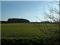
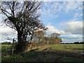
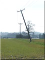
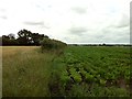
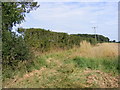
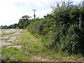
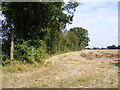
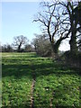
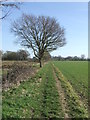
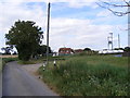
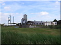
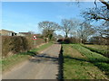
Living in Wenhaston with Mells Hamlet means residing within a civil parish in the East Suffolk district of northeastern England. This area spans approximately 9.7 km² and encompasses the village of Wenhaston and the smaller settlement of Mells Hamlet. You are situated south of the River Blyth in a region defined by the Suffolk Coast and Heaths Area of Outstanding Natural Beauty. The landscape includes narrow country lanes, hedgerows, and private frontages that characterise the streetscape. Most of the population resides in the clusters around Wenhaston village and Blackheath. You inherit a deep history here, with Roman settlements dating back to the Flavian period and a first written record in the Domesday Book of 1086. The parish contains approximately 430 households spread across its 8000 hectares. Notable features include St Peter's Church and the Grade II listed structures such as St Vulcan's and Myrtle's. Daily life revolves around these historic landmarks and the rural setting of the village.

Area Type
Parish
Area Size
9.7 km²
Population
Not available
Population Density
Not available

Demographics

The community profile of Wenhaston with Mells Hamlet reflects a settled population with a median age of 70. This demographic indicates that the village is home to many of its longest-term residents. Approximately 76% of households in the parish own their homes outright or with a mortgage. The remaining households include tenants and shared ownership buyers, though owner-occupancy remains the dominant form of tenure. Age range data confirms that "Age: Total" represents the most common category, reflecting the entirety of the population structure. There is no specific data provided on predominant ethnic groups, religion, or detailed household composition breakdowns beyond the total figures. This absence of granular diversity statistics suggests a demographic picture dominated by local, older families and couples. The home ownership level at 76% points to an area where stability and long-term residency are key characteristics. You will find a community where the majority of residents have deep roots in the parish rather than transient populations.

Household Size

total
most common

Accommodation Type

total
most common

Tenure

76
majority

Ethnic Group

total
most common

Religion

total
most common

Household Composition

total
most common

Age

70
median
Age: Total
most common

Household Deprivation

N/A
with no deprivation

NS-SEC

39
in Lower managerial occupations

Explore more demographic insights in this area

Go to Demographics tab

Planning

Planning Constraints

  • Flood Risk
    Premium
  • Ramsar Wetland Sites
    Premium
  • Area of Outstanding Natural Beauty
    Premium
  • Protected Nature Reserve
    Premium
  • Protected Woodland
    Premium
  • Crime Risk
    Premium

Explore more planning insights in this area

Open Planning map

Frequently Asked Questions

What is the demographic profile of people living in Wenhaston with Mells Hamlet?
The median age in the parish is 70, indicating a predominantly older population. Approximately 76% of households own their homes, suggesting deep local roots rather than a transient community. There is no specific data on religious or ethnic breakdowns, but the age profile confirms this is a village settled by long-term residents. The most common age bracket encompasses the total population, reflecting an older demographic structure typical of rural Suffolk villages.
How is internet connectivity for remote workers in Wenhaston with Mells Hamlet?
Mobile coverage scores 79 out of 100, showing good quality network reception across the parish. Fixed broadband quality is fair with a score of 55 out of 100. This means mobile data will suffice for most tasks, but fixed line speeds may not match urban standards. Residents should test lines before moving in to ensure fixed broadband meets their work-from-home requirements.
Are there environmental risks I should consider when buying a home here?
Flood risk is a notable concern with a warning level and a score of 15.13 out of 100, indicating medium flood risk coverage. You must inspect individual properties for flood history. Conversely, the area has a safe crime rating of 87 out of 100. Planning rules are strict due to AONB designation, which prevents unrestricted development but preserves the rural character of the village.
What makes the community feel distinct in Wenhaston with Mells Hamlet?
With approximately 430 households spread over 9.7 km², the community is compact and rural. The high 76% home ownership rate reinforces a stable environment where residents often stay for decades. Streets are defined by narrow lanes and hedgerows, and the area features historic landmarks like St Peter's Church and St Vulcan's. This setting creates a traditional village atmosphere rather than a modern bustle.

We use cookies to provide you with the best experience. By continuing, you agree to our Cookie Policy .