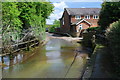
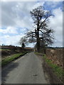
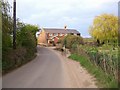
Area Overview for Welwyn West Ward
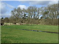
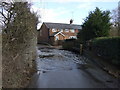
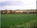
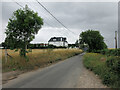
Photos of Welwyn West Ward

Area Information
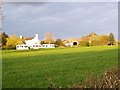
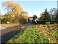
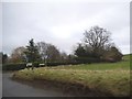
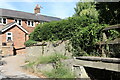
Welwyn West Ward sits within the borough of Welwyn Hatfield in Hertfordshire, forming a distinctive part of the wider Welwyn area. The ward covers an area of 12.6 square kilometres and held a recorded population of 6,158 people at the 2021 census. Its general characteristics reflect a mature residential settlement with specific local governance structures under the district council. The location is positioned roughly at 51.832°N and 0.232°W, placing it firmly within the Eastern region of England. Life here revolves around a established community structure rather than rapid development. The ward benefits from significant transport infrastructure, specifically access to six railway stations on the Great Northern Railway and service via the A1 road. These connections link residents to the broader network of services within the borough. The ward represents a settled environment where daily routines are supported by proximity to key arterial routes. Prospective residents moving to Welwyn West Ward encounter a landscape defined by its electoral boundaries and local history. The area serves as a functional unit of Welwyn Hatfield, linking homebuyers to essential services and regional transport hubs. Understanding the ward's boundaries and population history provides a clear picture of the living environment. The combination of road and rail access ensures that households can easily commute while remaining located within a defined local community.
- Area Type
- District Borough Unitary Ward
- Area Size
- 12.6 km²
- Population
- Not available
- Population Density
- Not available
Demographics
Heartland of Welwyn West Ward is an older demographic, with a median age estimated at 70 years. The population composition skews heavily towards senior residents, shaping the social rhythm of the ward. This age profile indicates a community where long-term residents have deep roots in the local area. The high proportion of retirees influences local business offerings and community activities, focusing on services tailored to older adults. Home ownership defines the character of households in this ward, with 78% of residents owning their property. This significant ownership rate suggests financial stability and a long-term commitment to the locality. The low rental market share reflects a housing stock dominated by owner-occupiers rather than tenants. Such a demographic structure often leads to lower transient turnover and a more stable neighbourhood environment. The ward lacks detailed breakdowns regarding specific ethnic groups, religious adherence, or precise household size statistics in the current records. However, the prevailing data points to an older, owner-led community structure. The absence of young families in the age statistics may impact local demand for certain family-oriented amenities. Residents in Welwyn West Ward represent a snapshot of a demographic shifting towards retirement, where personal networks and established properties form the core of social life.
Household Size
Accommodation Type
Tenure
Ethnic Group
Religion
Household Composition
Age
Household Deprivation
NS-SEC
Explore more demographic insights in this area
Go to Demographics tabPlanning
Planning Constraints
- Flood RiskPremium
- Ramsar Wetland SitesPremium
- Area of Outstanding Natural BeautyPremium
- Protected Nature ReservePremium
- Protected WoodlandPremium
- Crime RiskPremium