Area Overview for Weeting
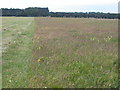
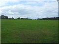
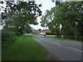
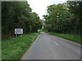
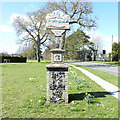
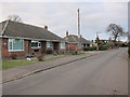
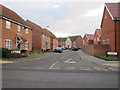
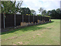
Photos of Weeting


Area Information
Living in Weeting offers a quiet, compact environment within a built-up area spanning 69.2 hectares in England. The community is characterised by its older demographic, with a median age of 70, suggesting a population that leans towards retirement or long-term residents. Daily life here is shaped by proximity to essential services, including five retail outlets such as Budgens Weeting and Tesco Brandon, and four rail stations, including Brandon Railway Station. The area’s digital connectivity is strong, with a broadband score of 97, ensuring reliable internet for both work and leisure. Nearby, RAF Lakenheath provides a unique local presence. Weeting’s low crime risk score of 82 means residents can enjoy a safer neighbourhood, though the area’s small size means it lacks the sprawling amenities of larger towns. For those seeking a low-maintenance, stable lifestyle with access to basic services, Weeting offers a straightforward, practical option.
- Area Type
- Built Up Area 250
- Area Size
- 69.2 hectares
- Population
- Not available
- Population Density
- Not available
Weeting’s lifestyle is defined by its practical amenities, including five retail outlets like Aldi Brandon and Tesco Brandon, which cater to daily needs. The four rail stations, including Brandon Railway Station, provide straightforward access to nearby areas, while RAF Lakenheath adds a distinct local character. Though the area lacks detailed information on parks or leisure facilities, the availability of multiple retail options and rail links suggests a functional, no-frills lifestyle. Residents can enjoy a mix of convenience and quietude, with services within easy reach. The absence of larger leisure venues means the area is best suited for those prioritising accessibility over expansive recreational opportunities.
Amenities
Schools
Weeting has two primary schools serving the area: Weeting Voluntary Controlled Primary School and Weeting Church of England Primary School, which holds an Ofsted rating of “good.” Both institutions cater to younger families, though the data does not specify secondary education options. The presence of two primary schools provides some choice for parents, though the limited scope to other school types means families may need to look beyond Weeting for secondary education. The “good” rating at the Church of England school suggests a reliable standard of teaching, but the overall school landscape remains modest, focusing on primary needs rather than comprehensive education.
| Rank | School | Type | Entry gender | Ages |
|---|
Explore more schools in this area
Go to Schools tabDemographics
Weeting’s population is predominantly older, with a median age of 70, reflecting a community where retirees and long-standing residents form the majority. Home ownership is high, with 75% of households owning their properties, suggesting a stable, settled population. The data does not specify household types or accommodation categories, but the overall profile indicates a mature demographic with fewer young families. The area’s diversity metrics are not detailed, but the absence of specific ethnic or religious breakdowns implies a homogenous population. This age structure may influence local services and amenities, with a focus on healthcare and leisure for older residents. While no deprivation data is provided, the high home ownership rate and low crime risk suggest a generally secure, self-sufficient community.
Household Size
Accommodation Type
Tenure
Ethnic Group
Religion
Household Composition
Age
Household Deprivation
NS-SEC
Explore more demographic insights in this area
Go to Demographics tabPlanning
Planning Constraints
- Crime RiskPremium