Area Overview for WD7 7HB
Photos of WD7 7HB
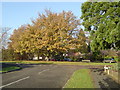
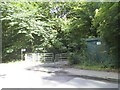
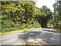
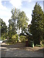
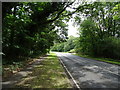
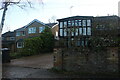
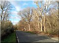
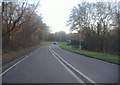
9 photos from this area
Area Information
Key information about the WD7 7HB including its size, population, and administrative classification.
- Area Type
- Postcode
- Area Size
- 11.9 hectares
- Population
- 1743
- Population Density
- 811 people/km²
House Prices in WD7 7HB
32
Properties
£1,089,339
Average Sold Price
£317,000
Lowest Price
£3,000,000
Highest Price
Showing 32 properties
| Address | Type | Beds | Baths | Last Sale Price | Last Sale Date | |
|---|---|---|---|---|---|---|
| 24 Williams Way, Radlett, WD7 7HB | house | - | - | £2,875,000 | Mar 2024 | |
| 52 Williams Way, Radlett, WD7 7HB | Bungalow | - | - | £1,230,000 | Aug 2022 | |
| 50 Williams Way, Radlett, WD7 7HB | Retail | 3 | 1 | £1,330,000 | Jun 2022 | |
| 72 Williams Way, Radlett, WD7 7HB | Detached | 3 | 1 | £990,000 | Sep 2021 | |
| 37 Williams Way, Radlett, WD7 7HB | Bungalow | 3 | 2 | £2,425,000 | Aug 2020 | |
| 18 Williams Way, Radlett, WD7 7HB | Detached | 6 | 6 | £3,000,000 | Apr 2019 | |
| 60 Williams Way, Radlett, WD7 7HB | Bungalow | 2 | 2 | £900,000 | Dec 2017 | |
| 54 Williams Way, Radlett, WD7 7HB | Detached | 4 | 2 | £1,100,000 | Nov 2017 | |
| 45 Williams Way, Radlett, WD7 7HB | Detached | 3 | 2 | £1,195,000 | Sep 2015 | |
| 32 Williams Way, Radlett, WD7 7HB | Bungalow | - | - | £894,000 | Feb 2014 |
Page 1 of 4
Energy Efficiency in WD7 7HB
Amenities
Schools
| Rank | School | Type | Entry gender | Ages |
|---|
Explore more schools in this area
Go to Schools tabDemographics
Household Size
Family (3-5 people)
most common
Accommodation Type
Houses
most common
Tenure
87
majority
Ethnic Group
White
most common
Religion
N/A
most common
Household Composition
N/A
most common
Age
47
median
Adults (30-64 years)
most common
Household Deprivation
N/A
with no deprivation
NS-SEC
55
in Lower managerial occupations
Explore more demographic insights in this area
Go to Demographics tabPlanning
Planning Constraints
- Flood RiskPremium
- Ramsar Wetland SitesPremium
- Area of Outstanding Natural BeautyPremium
- Protected Nature ReservePremium
- Protected WoodlandPremium