Area Overview for WD6 4LY
Photos of WD6 4LY
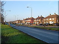
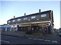
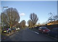
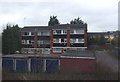
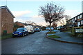
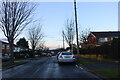
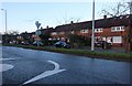
24 photos from this area
Area Information
Key information about the WD6 4LY including its size, population, and administrative classification.
- Area Type
- Postcode
- Area Size
- 6916 m²
- Population
- 2002
- Population Density
- 5899 people/km²
House Prices in WD6 4LY
23
Properties
£413,672
Average Sold Price
£85,000
Lowest Price
£1,075,000
Highest Price
Showing 23 properties
| Address | Type | Beds | Baths | Last Sale Price | Last Sale Date | |
|---|---|---|---|---|---|---|
| 15 Kingsley Avenue, Borehamwood, WD6 4LY | Terraced | 4 | 2 | £740,000 | Feb 2025 | |
| 16 Kingsley Avenue, Borehamwood, WD6 4LY | Detached | 4 | 2 | £1,075,000 | Jan 2025 | |
| 4 Kingsley Avenue, Borehamwood, WD6 4LY | Maisonette | 2 | 1 | £368,500 | Jul 2024 | |
| 23 Kingsley Avenue, Borehamwood, WD6 4LY | Terraced | 3 | 2 | £536,500 | Jun 2024 | |
| 10 Kingsley Avenue, Borehamwood, WD6 4LY | Maisonette | 1 | 1 | £262,500 | Aug 2021 | |
| 6 Kingsley Avenue, Borehamwood, WD6 4LY | Maisonette | 2 | 1 | £347,000 | Feb 2020 | |
| 5 Kingsley Avenue, Borehamwood, WD6 4LY | Terraced | 4 | 2 | £660,000 | Jan 2018 | |
| 11 Kingsley Avenue, Borehamwood, WD6 4LY | Terraced | 3 | 1 | £515,000 | Oct 2016 | |
| 14 Kingsley Avenue, Borehamwood, WD6 4LY | Detached | 4 | 2 | £795,000 | Jun 2016 | |
| 17 Kingsley Avenue, Borehamwood, WD6 4LY | house | 3 | 2 | £400,000 | Dec 2015 |
Page 1 of 3
Energy Efficiency in WD6 4LY
Amenities
Schools
| Rank | School | Type | Entry gender | Ages |
|---|
Explore more schools in this area
Go to Schools tabDemographics
Household Size
Family (3-5 people)
most common
Accommodation Type
Houses
most common
Tenure
58
majority
Ethnic Group
White
most common
Religion
N/A
most common
Household Composition
N/A
most common
Age
47
median
Adults (30-64 years)
most common
Household Deprivation
N/A
with no deprivation
NS-SEC
36
in Lower managerial occupations
Explore more demographic insights in this area
Go to Demographics tabPlanning
Planning Constraints
- Flood RiskPremium
- Ramsar Wetland SitesPremium
- Area of Outstanding Natural BeautyPremium
- Protected Nature ReservePremium
- Protected WoodlandPremium