Area Overview for WD6 4JX
Photos of WD6 4JX
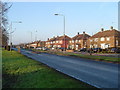
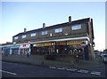
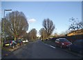
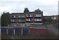
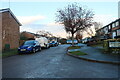
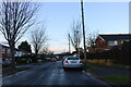
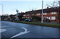
24 photos from this area
Area Information
Key information about the WD6 4JX including its size, population, and administrative classification.
- Area Type
- Postcode
- Area Size
- 1.1 hectares
- Population
- 1648
- Population Density
- 3280 people/km²
House Prices in WD6 4JX
29
Properties
£255,500
Average Sold Price
£96,000
Lowest Price
£470,000
Highest Price
Showing 29 properties
| Address | Type | Beds | Baths | Last Sale Price | Last Sale Date | |
|---|---|---|---|---|---|---|
| 41 Rossington Avenue, Borehamwood, WD6 4JX | house | 3 | 1 | £410,000 | Mar 2024 | |
| 53 Rossington Avenue, Borehamwood, WD6 4JX | Terraced | 3 | - | £370,000 | Jan 2024 | |
| 5 Rossington Avenue, Borehamwood, WD6 4JX | house | - | - | £368,000 | Aug 2016 | |
| 1 Rossington Avenue, Borehamwood, WD6 4JX | Terraced | 4 | 2 | £470,000 | May 2016 | |
| 39 Rossington Avenue, Borehamwood, WD6 4JX | Terraced | 4 | - | £278,000 | Mar 2014 | |
| 33 Rossington Avenue, Borehamwood, WD6 4JX | house | 1 | 1 | £305,000 | Sep 2012 | |
| 17 Rossington Avenue, Borehamwood, WD6 4JX | Terraced | 3 | 1 | £250,000 | Aug 2012 | |
| 13 Rossington Avenue, Borehamwood, WD6 4JX | Bungalow | 1 | 1 | £165,000 | Nov 2010 | |
| 23 Rossington Avenue, Borehamwood, WD6 4JX | house | - | - | £246,000 | Aug 2007 | |
| 7 Rossington Avenue, Borehamwood, WD6 4JX | Terraced | - | - | £195,000 | Mar 2007 |
Page 1 of 3
Energy Efficiency in WD6 4JX
Amenities
Schools
| Rank | School | Type | Entry gender | Ages |
|---|
Explore more schools in this area
Go to Schools tabDemographics
Household Size
Family (3-5 people)
most common
Accommodation Type
Houses
most common
Tenure
57
majority
Ethnic Group
White
most common
Religion
N/A
most common
Household Composition
N/A
most common
Age
47
median
Adults (30-64 years)
most common
Household Deprivation
N/A
with no deprivation
NS-SEC
30
in Lower managerial occupations
Explore more demographic insights in this area
Go to Demographics tabPlanning
Planning Constraints
- Flood RiskPremium
- Ramsar Wetland SitesPremium
- Area of Outstanding Natural BeautyPremium
- Protected Nature ReservePremium
- Protected WoodlandPremium