Area Overview for WD6 3HN
Photos of WD6 3HN
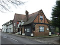
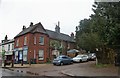
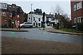
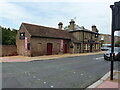
57 photos from this area
Area Information
Key information about the WD6 3HN including its size, population, and administrative classification.
- Area Type
- Postcode
- Area Size
- 9064 m²
- Population
- 1737
- Population Density
- 902 people/km²
House Prices in WD6 3HN
49
Properties
£204,484
Average Sold Price
£60,000
Lowest Price
£450,000
Highest Price
Showing 49 properties
| Address | Type | Beds | Baths | Last Sale Price | Last Sale Date | |
|---|---|---|---|---|---|---|
| 23 Rodgers Close, Elstree, WD6 3HN | Terraced | 2 | 2 | £450,000 | Feb 2024 | |
| 2 Rodgers Close, Elstree, WD6 3HN | Semi-detached | 2 | 1 | £410,000 | Aug 2023 | |
| 15 Rodgers Close, Elstree, WD6 3HN | house | 1 | 1 | £238,000 | Apr 2023 | |
| 11 Rodgers Close, Elstree, WD6 3HN | Terraced | 2 | 1 | £390,000 | Apr 2022 | |
| 34 Rodgers Close, Elstree, WD6 3HN | Terraced | 1 | - | £285,000 | Feb 2021 | |
| 30 Rodgers Close, Elstree, WD6 3HN | Terraced | 3 | 1 | £350,000 | Aug 2020 | |
| 36 Rodgers Close, Elstree, WD6 3HN | Terraced | 3 | 1 | £370,000 | May 2019 | |
| 14 Rodgers Close, Elstree, WD6 3HN | Terraced | 3 | 1 | £380,000 | Feb 2019 | |
| 4 Rodgers Close, Elstree, WD6 3HN | Terraced | 2 | 1 | £380,000 | May 2018 | |
| 38 Rodgers Close, Elstree, WD6 3HN | Terraced | 2 | 1 | £347,000 | Jan 2018 |
Page 1 of 5
Energy Efficiency in WD6 3HN
Amenities
Schools
| Rank | School | Type | Entry gender | Ages |
|---|
Explore more schools in this area
Go to Schools tabDemographics
Household Size
Family (3-5 people)
most common
Accommodation Type
Houses
most common
Tenure
63
majority
Ethnic Group
White
most common
Religion
N/A
most common
Household Composition
N/A
most common
Age
47
median
Adults (30-64 years)
most common
Household Deprivation
N/A
with no deprivation
NS-SEC
38
in Lower managerial occupations
Explore more demographic insights in this area
Go to Demographics tabPlanning
Planning Constraints
- Flood RiskPremium
- Ramsar Wetland SitesPremium
- Area of Outstanding Natural BeautyPremium
- Protected Nature ReservePremium
- Protected WoodlandPremium