Area Overview for WD6 2QL
Photos of WD6 2QL
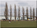
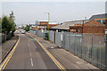
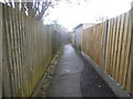

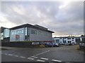
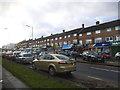
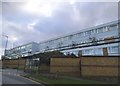
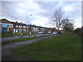
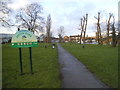
34 photos from this area
Area Information
Key information about the WD6 2QL including its size, population, and administrative classification.
- Area Type
- Postcode
- Area Size
- 4822 m²
- Population
- 1869
- Population Density
- 5515 people/km²
House Prices in WD6 2QL
39
Properties
£98,568
Average Sold Price
£30,750
Lowest Price
£212,500
Highest Price
Showing 39 properties
| Address | Type | Beds | Baths | Last Sale Price | Last Sale Date | |
|---|---|---|---|---|---|---|
| 129 Balmoral Drive, Borehamwood, WD6 2QL | Flat | - | - | £165,000 | Mar 2014 | |
| 109 Balmoral Drive, Borehamwood, WD6 2QL | Flat | - | - | £157,500 | Jun 2010 | |
| 115 Balmoral Drive, Borehamwood, WD6 2QL | Flat | - | - | £119,500 | Sep 2006 | |
| 85 Balmoral Drive, Borehamwood, WD6 2QL | house | - | - | £116,500 | Feb 2005 | |
| 73 Balmoral Drive, Borehamwood, WD6 2QL | Semi-detached | - | - | £212,500 | Mar 2004 | |
| 111 Balmoral Drive, Borehamwood, WD6 2QL | Flat | - | - | £75,000 | Sep 2001 | |
| 101 Balmoral Drive, Borehamwood, WD6 2QL | Flat | - | - | £62,000 | Jul 2000 | |
| 121 Balmoral Drive, Borehamwood, WD6 2QL | Flat | - | - | £63,500 | Jul 2000 | |
| 91 Balmoral Drive, Borehamwood, WD6 2QL | Flat | - | - | £46,000 | Dec 1998 | |
| 77 Balmoral Drive, Borehamwood, WD6 2QL | Flat | - | - | £36,000 | May 1997 |
Page 1 of 4
Energy Efficiency in WD6 2QL
Amenities
Schools
| Rank | School | Type | Entry gender | Ages |
|---|
Explore more schools in this area
Go to Schools tabDemographics
Household Size
Family (3-5 people)
most common
Accommodation Type
Houses
most common
Tenure
47
majority
Ethnic Group
White
most common
Religion
N/A
most common
Household Composition
N/A
most common
Age
47
median
Adults (30-64 years)
most common
Household Deprivation
N/A
with no deprivation
NS-SEC
28
in Lower managerial occupations
Explore more demographic insights in this area
Go to Demographics tabPlanning
Planning Constraints
- Flood RiskPremium
- Ramsar Wetland SitesPremium
- Area of Outstanding Natural BeautyPremium
- Protected Nature ReservePremium
- Protected WoodlandPremium