Area Overview for WD6 2ER
Photos of WD6 2ER

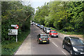
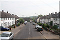
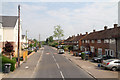
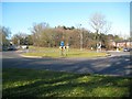
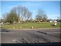
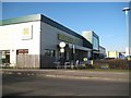
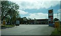
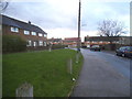
35 photos from this area
Area Information
Key information about the WD6 2ER including its size, population, and administrative classification.
- Area Type
- Postcode
- Area Size
- 8344 m²
- Population
- 1952
- Population Density
- 3086 people/km²
House Prices in WD6 2ER
26
Properties
£331,387
Average Sold Price
£61,380
Lowest Price
£625,000
Highest Price
Showing 26 properties
| Address | Type | Beds | Baths | Last Sale Price | Last Sale Date | |
|---|---|---|---|---|---|---|
| 40 Cleveland Crescent, Borehamwood, WD6 2ER | Detached | 3 | - | £425,000 | Mar 2025 | |
| 8 Cleveland Crescent, Borehamwood, WD6 2ER | house | - | - | £625,000 | Nov 2023 | |
| 32 Cleveland Crescent, Borehamwood, WD6 2ER | Terraced | 3 | 1 | £512,000 | Jan 2023 | |
| 16 Cleveland Crescent, Borehamwood, WD6 2ER | Semi-detached | 3 | 1 | £618,000 | Oct 2022 | |
| 6 Cleveland Crescent, Borehamwood, WD6 2ER | Terraced | 3 | 1 | £478,500 | May 2022 | |
| 26 Cleveland Crescent, Borehamwood, WD6 2ER | Terraced | 3 | 1 | £465,000 | May 2017 | |
| 22 Cleveland Crescent, Borehamwood, WD6 2ER | Terraced | 3 | 1 | £504,200 | Jan 2017 | |
| 48 Cleveland Crescent, Borehamwood, WD6 2ER | Terraced | 3 | 1 | £284,495 | Apr 2014 | |
| 46 Cleveland Crescent, Borehamwood, WD6 2ER | house | 3 | 1 | £315,000 | Oct 2013 | |
| 42 Cleveland Crescent, Borehamwood, WD6 2ER | house | 4 | 1 | £280,000 | Nov 2011 |
Page 1 of 3
Energy Efficiency in WD6 2ER
Amenities
Schools
| Rank | School | Type | Entry gender | Ages |
|---|
Explore more schools in this area
Go to Schools tabDemographics
Household Size
Family (3-5 people)
most common
Accommodation Type
Houses
most common
Tenure
64
majority
Ethnic Group
White
most common
Religion
N/A
most common
Household Composition
N/A
most common
Age
47
median
Adults (30-64 years)
most common
Household Deprivation
N/A
with no deprivation
NS-SEC
33
in Lower managerial occupations
Explore more demographic insights in this area
Go to Demographics tabPlanning
Planning Constraints
- Flood RiskPremium
- Ramsar Wetland SitesPremium
- Area of Outstanding Natural BeautyPremium
- Protected Nature ReservePremium
- Protected WoodlandPremium