Area Overview for WD6 1RF
Photos of WD6 1RF
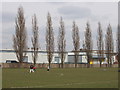
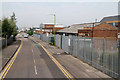

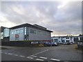
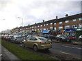
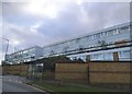
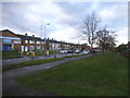
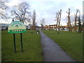
34 photos from this area
Area Information
Key information about the WD6 1RF including its size, population, and administrative classification.
- Area Type
- Postcode
- Area Size
- 6943 m²
- Population
- 2487
- Population Density
- 4464 people/km²
House Prices in WD6 1RF
19
Properties
£336,500
Average Sold Price
£110,000
Lowest Price
£660,000
Highest Price
Showing 19 properties
| Address | Type | Beds | Baths | Last Sale Price | Last Sale Date | |
|---|---|---|---|---|---|---|
| 32 Thornbury Gardens, Borehamwood, WD6 1RF | Semi-detached | 3 | 1 | £560,000 | Nov 2024 | |
| 10 Thornbury Gardens, Borehamwood, WD6 1RF | house | 3 | 2 | £558,000 | Sep 2020 | |
| 12 Thornbury Gardens, Borehamwood, WD6 1RF | Semi-detached | 4 | 2 | £554,500 | Jul 2018 | |
| 24 Thornbury Gardens, Borehamwood, WD6 1RF | Semi-detached | 4 | 2 | £660,000 | Jul 2017 | |
| 18 Thornbury Gardens, Borehamwood, WD6 1RF | house | 3 | 1 | £430,000 | Mar 2015 | |
| 30 Thornbury Gardens, Borehamwood, WD6 1RF | house | 4 | 1 | £420,000 | Nov 2014 | |
| 8 Thornbury Gardens, Borehamwood, WD6 1RF | Semi-detached | 3 | 1 | £361,000 | Feb 2014 | |
| 26 Thornbury Gardens, Borehamwood, WD6 1RF | Semi-detached | - | - | £288,000 | Mar 2006 | |
| 20 Thornbury Gardens, Borehamwood, WD6 1RF | house | - | - | £235,000 | Sep 2005 | |
| 14 Thornbury Gardens, Borehamwood, WD6 1RF | house | - | - | £249,995 | Aug 2005 |
Page 1 of 2
Energy Efficiency in WD6 1RF
Amenities
Schools
| Rank | School | Type | Entry gender | Ages |
|---|
Explore more schools in this area
Go to Schools tabDemographics
Household Size
Family (3-5 people)
most common
Accommodation Type
Houses
most common
Tenure
66
majority
Ethnic Group
White
most common
Religion
N/A
most common
Household Composition
N/A
most common
Age
47
median
Adults (30-64 years)
most common
Household Deprivation
N/A
with no deprivation
NS-SEC
42
in Lower managerial occupations
Explore more demographic insights in this area
Go to Demographics tabPlanning
Planning Constraints
- Flood RiskPremium
- Ramsar Wetland SitesPremium
- Area of Outstanding Natural BeautyPremium
- Protected Nature ReservePremium
- Protected WoodlandPremium