Area Overview for WD5 0TG
Photos of WD5 0TG
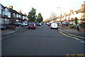
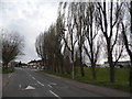
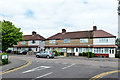
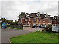
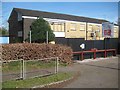
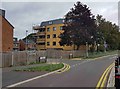
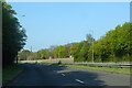
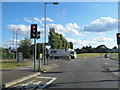
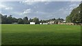
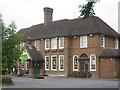
10 photos from this area
Area Information
Key information about the WD5 0TG including its size, population, and administrative classification.
- Area Type
- Postcode
- Area Size
- 6962 m²
- Population
- 1246
- Population Density
- 4122 people/km²
House Prices in WD5 0TG
23
Properties
£290,171
Average Sold Price
£69,995
Lowest Price
£725,000
Highest Price
Showing 23 properties
| Address | Type | Beds | Baths | Last Sale Price | Last Sale Date | |
|---|---|---|---|---|---|---|
| 32 Blenheim Road, Abbots Langley, WD5 0TG | Detached | 4 | 2 | £725,000 | Nov 2023 | |
| 20 Blenheim Road, Abbots Langley, WD5 0TG | house | - | - | £425,000 | Mar 2022 | |
| 6 Blenheim Road, Abbots Langley, WD5 0TG | house | - | - | £390,000 | May 2018 | |
| 26 Blenheim Road, Abbots Langley, WD5 0TG | house | 2 | - | £378,000 | Apr 2018 | |
| 24 Blenheim Road, Abbots Langley, WD5 0TG | Terraced | 2 | 1 | £420,000 | Feb 2017 | |
| 9 Blenheim Road, Abbots Langley, WD5 0TG | Terraced | 2 | 1 | £370,000 | Jun 2016 | |
| 10 Blenheim Road, Abbots Langley, WD5 0TG | house | 2 | - | £235,000 | Jul 2013 | |
| 34 Blenheim Road, Abbots Langley, WD5 0TG | Detached | 4 | - | £545,000 | May 2013 | |
| 5 Blenheim Road, Abbots Langley, WD5 0TG | house | - | - | £240,000 | Aug 2012 | |
| 28 Blenheim Road, Abbots Langley, WD5 0TG | house | 2 | - | £220,000 | Jun 2012 |
Page 1 of 3
Energy Efficiency in WD5 0TG
Amenities
Schools
| Rank | School | Type | Entry gender | Ages |
|---|
Explore more schools in this area
Go to Schools tabDemographics
Household Size
Family (3-5 people)
most common
Accommodation Type
Houses
most common
Tenure
83
majority
Ethnic Group
White
most common
Religion
N/A
most common
Household Composition
N/A
most common
Age
47
median
Adults (30-64 years)
most common
Household Deprivation
N/A
with no deprivation
NS-SEC
45
in Lower managerial occupations
Explore more demographic insights in this area
Go to Demographics tabPlanning
Planning Constraints
- Flood RiskPremium
- Ramsar Wetland SitesPremium
- Area of Outstanding Natural BeautyPremium
- Protected Nature ReservePremium
- Protected WoodlandPremium