Area Overview for WD4 8AN
Photos of WD4 8AN
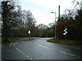
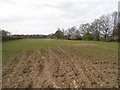
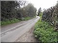
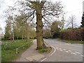
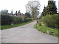
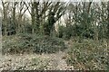
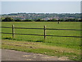
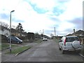
9 photos from this area
Area Information
Key information about the WD4 8AN including its size, population, and administrative classification.
- Area Type
- Postcode
- Area Size
- 3.2 hectares
- Population
- 1721
- Population Density
- 539 people/km²
House Prices in WD4 8AN
28
Properties
£403,625
Average Sold Price
£134,000
Lowest Price
£635,000
Highest Price
Showing 28 properties
| Address | Type | Beds | Baths | Last Sale Price | Last Sale Date | |
|---|---|---|---|---|---|---|
| 33 Barnes Rise, Kings Langley, WD4 8AN | Bungalow | 3 | 1 | £618,000 | Aug 2025 | |
| 3 Barnes Rise, Kings Langley, WD4 8AN | Bungalow | 2 | 2 | £635,000 | Dec 2023 | |
| 5 Barnes Rise, Kings Langley, WD4 8AN | Bungalow | 3 | - | £515,000 | Feb 2022 | |
| 29 Barnes Rise, Kings Langley, WD4 8AN | Bungalow | 2 | 1 | £395,000 | Jan 2020 | |
| 9 Barnes Rise, Kings Langley, WD4 8AN | Bungalow | 4 | 2 | £585,000 | Sep 2017 | |
| The Squirrels, 1 Barnes Rise, Kings Langley, WD4 8AN | house | - | - | £549,000 | Nov 2015 | |
| 12 Barnes Rise, Kings Langley, WD4 8AN | Bungalow | 2 | - | £410,000 | Apr 2013 | |
| 11 Barnes Rise, Kings Langley, WD4 8AN | Bungalow | 3 | - | £335,000 | Dec 2012 | |
| 2 Barnes Rise, Kings Langley, WD4 8AN | Detached | - | - | £290,000 | Apr 2004 | |
| 13 Barnes Rise, Kings Langley, WD4 8AN | Bungalow | 4 | 2 | £222,500 | Mar 2002 |
Page 1 of 3
Energy Efficiency in WD4 8AN
Amenities
Schools
| Rank | School | Type | Entry gender | Ages |
|---|
Explore more schools in this area
Go to Schools tabDemographics
Household Size
Family (3-5 people)
most common
Accommodation Type
Houses
most common
Tenure
78
majority
Ethnic Group
White
most common
Religion
N/A
most common
Household Composition
N/A
most common
Age
47
median
Adults (30-64 years)
most common
Household Deprivation
N/A
with no deprivation
NS-SEC
45
in Lower managerial occupations
Explore more demographic insights in this area
Go to Demographics tabPlanning
Planning Constraints
- Flood RiskPremium
- Ramsar Wetland SitesPremium
- Area of Outstanding Natural BeautyPremium
- Protected Nature ReservePremium
- Protected WoodlandPremium