Area Overview for WD3 6AR
Photos of WD3 6AR
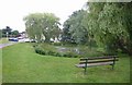
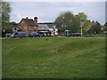

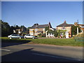


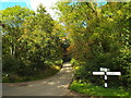
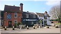
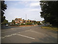
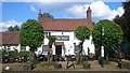
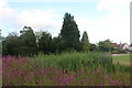
47 photos from this area
Area Information
Key information about the WD3 6AR including its size, population, and administrative classification.
- Area Type
- Postcode
- Area Size
- 1.8 hectares
- Population
- 1932
- Population Density
- 94 people/km²
House Prices in WD3 6AR
19
Properties
£627,040
Average Sold Price
£170,000
Lowest Price
£935,000
Highest Price
Showing 19 properties
| Address | Type | Beds | Baths | Last Sale Price | Last Sale Date | |
|---|---|---|---|---|---|---|
| Peel Cottage, Dimmocks Lane, Sarratt, WD3 6AR | Detached | 4 | - | £685,000 | Mar 2019 | |
| Crestyl, Dimmocks Lane, Sarratt, WD3 6AR | Bungalow | 5 | - | £935,000 | Dec 2016 | |
| Little Heddon, Dimmocks Lane, Sarratt, WD3 6AR | Bungalow | 2 | - | £725,000 | Oct 2016 | |
| Willow Tree, Dimmocks Lane, Sarratt, WD3 6AR | Detached | 4 | - | £935,000 | Dec 2015 | |
| Syringa Cottage, Dimmocks Lane, Sarratt, WD3 6AR | Detached | 3 | 2 | £510,500 | Mar 2014 | |
| Hedgerow, Dimmocks Lane, Sarratt, WD3 6AR | Detached | 4 | 2 | £815,000 | Jan 2014 | |
| Merrylea, Dimmocks Lane, Sarratt, WD3 6AR | house | 4 | - | £620,000 | Sep 2012 | |
| Holly Cottage, Dimmocks Lane, Sarratt, WD3 6AR | Detached | - | - | £499,900 | Jan 2008 | |
| Belford, Dimmocks Lane, Sarratt, WD3 6AR | Detached | 4 | - | £375,000 | Mar 2005 | |
| Green Hill Cottage, Dimmocks Lane, Sarratt, WD3 6AR | Detached | - | - | £170,000 | Jan 1995 |
Page 1 of 2
Energy Efficiency in WD3 6AR
Amenities
Schools
| Rank | School | Type | Entry gender | Ages |
|---|
Explore more schools in this area
Go to Schools tabDemographics
Household Size
Two person
most common
Accommodation Type
Houses
most common
Tenure
82
majority
Ethnic Group
White
most common
Religion
N/A
most common
Household Composition
N/A
most common
Age
47
median
Adults (30-64 years)
most common
Household Deprivation
N/A
with no deprivation
NS-SEC
46
in Lower managerial occupations
Explore more demographic insights in this area
Go to Demographics tabPlanning
Planning Constraints
- Flood RiskPremium
- Ramsar Wetland SitesPremium
- Area of Outstanding Natural BeautyPremium
- Protected Nature ReservePremium
- Protected WoodlandPremium