Area Overview for WD3 5JS
Photos of WD3 5JS
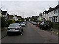
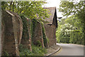
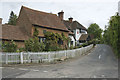
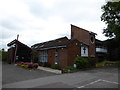
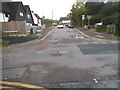
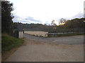

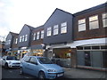
74 photos from this area
Area Information
Key information about the WD3 5JS including its size, population, and administrative classification.
- Area Type
- Postcode
- Area Size
- 3.5 hectares
- Population
- 1284
- Population Density
- 1143 people/km²
House Prices in WD3 5JS
25
Properties
£548,956
Average Sold Price
£123,000
Lowest Price
£1,000,000
Highest Price
Showing 25 properties
| Address | Type | Beds | Baths | Last Sale Price | Last Sale Date | |
|---|---|---|---|---|---|---|
| 11 Clements Road, Chorleywood, WD3 5JS | Retail | 3 | 2 | £925,000 | Sep 2022 | |
| 17 Clements Road, Chorleywood, WD3 5JS | Bungalow | 2 | 3 | £1,000,000 | Oct 2019 | |
| 7 Clements Road, Chorleywood, WD3 5JS | Bungalow | 3 | - | £725,500 | May 2018 | |
| 49 Clements Road, Chorleywood, WD3 5JS | Bungalow | 3 | - | £738,000 | Dec 2016 | |
| Cherry Cottage, 31 Clements Road, Chorleywood, WD3 5JS | Bungalow | 4 | 2 | £812,500 | Mar 2016 | |
| 21 Clements Road, Chorleywood, WD3 5JS | Bungalow | 4 | 2 | £790,000 | Jul 2015 | |
| Pefka, 19 Clements Road, Chorleywood, WD3 5JS | Detached | 3 | - | £706,120 | Feb 2015 | |
| 3 Clements Road, Chorleywood, WD3 5JS | Detached | 2 | 1 | £965,000 | May 2014 | |
| Beverly, 39 Clements Road, Chorleywood, WD3 5JS | Detached | 3 | - | £635,000 | Nov 2013 | |
| 29 Clements Road, Chorleywood, WD3 5JS | Semi-detached | 2 | 1 | £177,000 | Jul 2013 |
Page 1 of 3
Energy Efficiency in WD3 5JS
Amenities
Schools
| Rank | School | Type | Entry gender | Ages |
|---|
Explore more schools in this area
Go to Schools tabDemographics
Household Size
Family (3-5 people)
most common
Accommodation Type
Houses
most common
Tenure
78
majority
Ethnic Group
White
most common
Religion
N/A
most common
Household Composition
N/A
most common
Age
47
median
Adults (30-64 years)
most common
Household Deprivation
N/A
with no deprivation
NS-SEC
54
in Lower managerial occupations
Explore more demographic insights in this area
Go to Demographics tabPlanning
Planning Constraints
- Flood RiskPremium
- Ramsar Wetland SitesPremium
- Area of Outstanding Natural BeautyPremium
- Protected Nature ReservePremium
- Protected WoodlandPremium