Area Overview for WD3 5AG
Photos of WD3 5AG
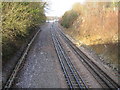
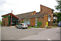
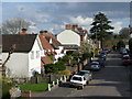
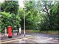
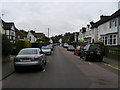
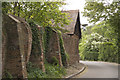
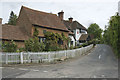
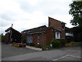
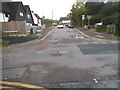
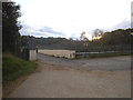

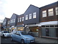
74 photos from this area
Area Information
Key information about the WD3 5AG including its size, population, and administrative classification.
- Area Type
- Postcode
- Area Size
- 1.4 hectares
- Population
- 1284
- Population Density
- 1143 people/km²
House Prices in WD3 5AG
16
Properties
£987,352
Average Sold Price
£273,000
Lowest Price
£1,680,000
Highest Price
Showing 16 properties
| Address | Type | Beds | Baths | Last Sale Price | Last Sale Date | |
|---|---|---|---|---|---|---|
| Overdale, 21 Berks Hill, Chorleywood, WD3 5AG | Detached | 4 | 1 | £1,240,000 | Jun 2024 | |
| The Laurels, 27 Berks Hill, Chorleywood, WD3 5AG | Detached | 5 | 2 | £1,180,000 | Oct 2021 | |
| Frognal, 25 Berks Hill, Chorleywood, WD3 5AG | Detached | 6 | 1 | £1,100,000 | Aug 2016 | |
| Orchard House, 11 Berks Hill, Chorleywood, WD3 5AG | Detached | 6 | 3 | £1,680,000 | Jun 2016 | |
| Sunnyside, 3 Berks Hill, Chorleywood, WD3 5AG | Detached | 5 | 3 | £1,500,000 | Sep 2015 | |
| Northfield, 17 Berks Hill, Chorleywood, WD3 5AG | Detached | 5 | 3 | £1,400,000 | Aug 2014 | |
| Pennhurst, 1 Berks Hill, Chorleywood, WD3 5AG | Detached | 4 | 2 | £815,000 | Jan 2012 | |
| Ardestie, 29 Berks Hill, Chorleywood, WD3 5AG | Detached | 5 | 3 | £1,050,000 | Aug 2010 | |
| Foxdale, 7 Berks Hill, Chorleywood, WD3 5AG | house | - | - | £830,000 | Apr 2009 | |
| The Annexe, 19A Berks Hill, Chorleywood, WD3 5AG | Flat | - | - | £649,000 | Feb 2004 |
Page 1 of 2
Energy Efficiency in WD3 5AG
Amenities
Schools
| Rank | School | Type | Entry gender | Ages |
|---|
Explore more schools in this area
Go to Schools tabDemographics
Household Size
Family (3-5 people)
most common
Accommodation Type
Houses
most common
Tenure
78
majority
Ethnic Group
White
most common
Religion
N/A
most common
Household Composition
N/A
most common
Age
47
median
Adults (30-64 years)
most common
Household Deprivation
N/A
with no deprivation
NS-SEC
54
in Lower managerial occupations
Explore more demographic insights in this area
Go to Demographics tabPlanning
Planning Constraints
- Flood RiskPremium
- Ramsar Wetland SitesPremium
- Area of Outstanding Natural BeautyPremium
- Protected Nature ReservePremium
- Protected WoodlandPremium