Area Overview for WD3 1GY
Photos of WD3 1GY

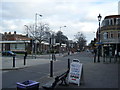
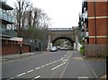
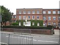
100 photos from this area
Area Information
Key information about the WD3 1GY including its size, population, and administrative classification.
- Area Type
- Postcode
- Area Size
- 4546 m²
- Population
- 1577
- Population Density
- 3168 people/km²
House Prices in WD3 1GY
15
Properties
£209,567
Average Sold Price
£140,000
Lowest Price
£383,000
Highest Price
Showing 15 properties
| Address | Type | Beds | Baths | Last Sale Price | Last Sale Date | |
|---|---|---|---|---|---|---|
| 129, Penn Place, Solomons Hill, Rickmansworth, WD3 1GY | Flat | 2 | 2 | £383,000 | Apr 2018 | |
| 138, Penn Place, Solomons Hill, Rickmansworth, WD3 1GY | Flat | - | - | £269,000 | Jan 2008 | |
| 142, Penn Place, Solomons Hill, Rickmansworth, WD3 1GY | Flat | 1 | 1 | £185,000 | Aug 2006 | |
| 137, Penn Place, Solomons Hill, Rickmansworth, WD3 1GY | Flat | 2 | 2 | £220,000 | Apr 2005 | |
| 131, Penn Place, Solomons Hill, Rickmansworth, WD3 1GY | Flat | - | - | £219,000 | Sep 2004 | |
| 139, Penn Place, Solomons Hill, Rickmansworth, WD3 1GY | Flat | - | - | £197,500 | Sep 2004 | |
| 134, Penn Place, Solomons Hill, Rickmansworth, WD3 1GY | Flat | - | - | £185,000 | Sep 2002 | |
| 135, Penn Place, Solomons Hill, Rickmansworth, WD3 1GY | Flat | - | - | £190,000 | Jun 2002 | |
| 136, Penn Place, Solomons Hill, Rickmansworth, WD3 1GY | Flat | - | - | £190,000 | Jun 2002 | |
| 132, Penn Place, Solomons Hill, Rickmansworth, WD3 1GY | Flat | - | - | £195,000 | Jun 2002 |
Page 1 of 2
Energy Efficiency in WD3 1GY
Amenities
Schools
| Rank | School | Type | Entry gender | Ages |
|---|
Explore more schools in this area
Go to Schools tabDemographics
Household Size
One person
most common
Accommodation Type
Flats
most common
Tenure
47
majority
Ethnic Group
White
most common
Religion
N/A
most common
Household Composition
N/A
most common
Age
47
median
Adults (30-64 years)
most common
Household Deprivation
N/A
with no deprivation
NS-SEC
49
in Lower managerial occupations
Explore more demographic insights in this area
Go to Demographics tabPlanning
Planning Constraints
- Flood RiskPremium
- Ramsar Wetland SitesPremium
- Area of Outstanding Natural BeautyPremium
- Protected Nature ReservePremium
- Protected WoodlandPremium