Area Overview for WD25 9QY
Photos of WD25 9QY
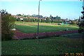
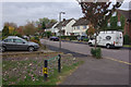
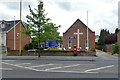
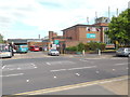


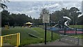
40 photos from this area
Area Information
Key information about the WD25 9QY including its size, population, and administrative classification.
- Area Type
- Postcode
- Area Size
- 8213 m²
- Population
- 1724
- Population Density
- 3856 people/km²
House Prices in WD25 9QY
17
Properties
£257,042
Average Sold Price
£196,750
Lowest Price
£403,000
Highest Price
Showing 17 properties
| Address | Type | Beds | Baths | Last Sale Price | Last Sale Date | |
|---|---|---|---|---|---|---|
| 58 Codicote Drive, Watford, WD25 9QY | Semi-detached | 3 | 1 | £403,000 | Jul 2020 | |
| 52 Codicote Drive, Watford, WD25 9QY | house | - | - | £250,000 | Sep 2011 | |
| 50 Codicote Drive, Watford, WD25 9QY | Semi-detached | 3 | 1 | £215,000 | Nov 2008 | |
| 56 Codicote Drive, Watford, WD25 9QY | house | - | - | £249,500 | Nov 2007 | |
| 62 Codicote Drive, Watford, WD25 9QY | house | - | - | £196,750 | Nov 2005 | |
| 36 Codicote Drive, Watford, WD25 9QY | Semi-detached | 3 | 1 | £228,000 | May 2004 | |
| 42 Codicote Drive, Watford, WD25 9QY | house | - | - | - | - | |
| 40 Codicote Drive, Watford, WD25 9QY | Terraced | - | - | - | - | |
| 66 Codicote Drive, Watford, WD25 9QY | Bungalow | - | - | - | - | |
| 64 Codicote Drive, Watford, WD25 9QY | house | - | - | - | - |
Page 1 of 2
Energy Efficiency in WD25 9QY
Amenities
Schools
| Rank | School | Type | Entry gender | Ages |
|---|
Explore more schools in this area
Go to Schools tabDemographics
Household Size
Family (3-5 people)
most common
Accommodation Type
Houses
most common
Tenure
55
majority
Ethnic Group
White
most common
Religion
N/A
most common
Household Composition
N/A
most common
Age
47
median
Adults (30-64 years)
most common
Household Deprivation
N/A
with no deprivation
NS-SEC
30
in Lower managerial occupations
Explore more demographic insights in this area
Go to Demographics tabPlanning
Planning Constraints
- Flood RiskPremium
- Ramsar Wetland SitesPremium
- Area of Outstanding Natural BeautyPremium
- Protected Nature ReservePremium
- Protected WoodlandPremium