Area Overview for WD25 8AJ
Photos of WD25 8AJ
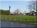


23 photos from this area
Area Information
Key information about the WD25 8AJ including its size, population, and administrative classification.
- Area Type
- Postcode
- Area Size
- 2.6 hectares
- Population
- 1971
- Population Density
- 823 people/km²
House Prices in WD25 8AJ
40
Properties
£503,516
Average Sold Price
£138,500
Lowest Price
£900,000
Highest Price
Showing 40 properties
| Address | Type | Beds | Baths | Last Sale Price | Last Sale Date | |
|---|---|---|---|---|---|---|
| 30 Hilfield Lane, Aldenham, WD25 8AJ | Semi-detached | 4 | 3 | £790,000 | Aug 2025 | |
| 10 Hilfield Lane, Aldenham, WD25 8AJ | Bungalow | 3 | 2 | £750,000 | Mar 2025 | |
| 26 Hilfield Lane, Aldenham, WD25 8AJ | Semi-detached | 3 | 1 | £800,000 | Nov 2024 | |
| 56 Hilfield Lane, Aldenham, WD25 8AJ | Semi-detached | 4 | 2 | £765,000 | Sep 2024 | |
| 28 Hilfield Lane, Aldenham, WD25 8AJ | Semi-detached | 3 | 1 | £730,000 | Sep 2024 | |
| 16 Hilfield Lane, Aldenham, WD25 8AJ | Semi-detached | 3 | 1 | £460,000 | Oct 2023 | |
| 54 Hilfield Lane, Aldenham, WD25 8AJ | house | - | - | £850,000 | Oct 2023 | |
| 62 Hilfield Lane, Aldenham, WD25 8AJ | house | 2 | - | £650,000 | Mar 2021 | |
| Site Of Former, 4 Hilfield Lane, Aldenham, WD25 8AJ | Detached | 4 | 3 | £200,000 | Feb 2021 | |
| 74 Hilfield Lane, Aldenham, WD25 8AJ | Semi-detached | 1 | 1 | £900,000 | May 2020 |
Page 1 of 4
Energy Efficiency in WD25 8AJ
Amenities
Schools
| Rank | School | Type | Entry gender | Ages |
|---|
Explore more schools in this area
Go to Schools tabDemographics
Household Size
Family (3-5 people)
most common
Accommodation Type
Houses
most common
Tenure
52
majority
Ethnic Group
White
most common
Religion
N/A
most common
Household Composition
N/A
most common
Age
47
median
Adults (30-64 years)
most common
Household Deprivation
N/A
with no deprivation
NS-SEC
36
in Lower managerial occupations
Explore more demographic insights in this area
Go to Demographics tabPlanning
Planning Constraints
- Flood RiskPremium
- Ramsar Wetland SitesPremium
- Area of Outstanding Natural BeautyPremium
- Protected Nature ReservePremium
- Protected WoodlandPremium