Area Overview for WD25 7HX
Photos of WD25 7HX

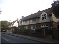
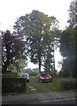
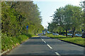
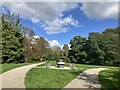
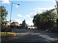
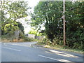
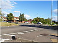
13 photos from this area
Area Information
Key information about the WD25 7HX including its size, population, and administrative classification.
- Area Type
- Postcode
- Area Size
- 1.6 hectares
- Population
- 2165
- Population Density
- 6932 people/km²
House Prices in WD25 7HX
44
Properties
£290,219
Average Sold Price
£86,000
Lowest Price
£585,000
Highest Price
Showing 44 properties
| Address | Type | Beds | Baths | Last Sale Price | Last Sale Date | |
|---|---|---|---|---|---|---|
| 58 Newhouse Crescent, Watford, WD25 7HX | Semi-detached | 2 | 1 | £380,000 | Jun 2023 | |
| 82 Newhouse Crescent, Watford, WD25 7HX | Retail | 3 | 1 | £465,000 | Sep 2022 | |
| 44 Newhouse Crescent, Watford, WD25 7HX | house | - | - | £480,000 | Dec 2021 | |
| 2 Newhouse Crescent, Watford, WD25 7HX | house | - | - | £585,000 | Nov 2021 | |
| 62 Newhouse Crescent, Watford, WD25 7HX | house | 3 | - | £400,000 | Jun 2021 | |
| 38 Newhouse Crescent, Watford, WD25 7HX | Terraced | 3 | 1 | £415,000 | Feb 2021 | |
| 64 Newhouse Crescent, Watford, WD25 7HX | Semi-detached | 4 | 1 | £370,000 | Feb 2020 | |
| 86 Newhouse Crescent, Watford, WD25 7HX | Semi-detached | 3 | - | £429,000 | Apr 2017 | |
| 72 Newhouse Crescent, Watford, WD25 7HX | house | - | - | £370,000 | Mar 2017 | |
| 84 Newhouse Crescent, Watford, WD25 7HX | house | - | - | £247,000 | Oct 2012 |
Page 1 of 5
Energy Efficiency in WD25 7HX
Amenities
Schools
| Rank | School | Type | Entry gender | Ages |
|---|
Explore more schools in this area
Go to Schools tabDemographics
Household Size
Family (3-5 people)
most common
Accommodation Type
Houses
most common
Tenure
57
majority
Ethnic Group
White
most common
Religion
N/A
most common
Household Composition
N/A
most common
Age
47
median
Adults (30-64 years)
most common
Household Deprivation
N/A
with no deprivation
NS-SEC
30
in Lower managerial occupations
Explore more demographic insights in this area
Go to Demographics tabPlanning
Planning Constraints
- Flood RiskPremium
- Ramsar Wetland SitesPremium
- Area of Outstanding Natural BeautyPremium
- Protected Nature ReservePremium
- Protected WoodlandPremium