Area Overview for WD25 7AQ
Photos of WD25 7AQ


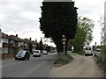
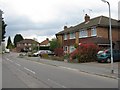
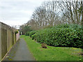
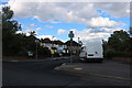

26 photos from this area
Area Information
Key information about the WD25 7AQ including its size, population, and administrative classification.
- Area Type
- Postcode
- Area Size
- 7107 m²
- Population
- 1938
- Population Density
- 4039 people/km²
House Prices in WD25 7AQ
14
Properties
£366,600
Average Sold Price
£169,950
Lowest Price
£535,000
Highest Price
Showing 14 properties
| Address | Type | Beds | Baths | Last Sale Price | Last Sale Date | |
|---|---|---|---|---|---|---|
| 54 High Road, Watford, WD25 7AQ | Semi-detached | 2 | 1 | £465,000 | Oct 2024 | |
| 38 High Road, Watford, WD25 7AQ | Bungalow | 2 | 1 | £520,000 | Mar 2023 | |
| 60 High Road, Watford, WD25 7AQ | Bungalow | - | - | £535,000 | Nov 2020 | |
| 42 High Road, Watford, WD25 7AQ | Bungalow | 2 | 1 | £385,000 | Jun 2020 | |
| 48 High Road, Watford, WD25 7AQ | Semi-detached | 2 | 1 | £460,000 | May 2018 | |
| 46 High Road, Watford, WD25 7AQ | Semi-detached | 2 | 1 | £370,000 | Aug 2016 | |
| 40 High Road, Watford, WD25 7AQ | Bungalow | 2 | 1 | £337,000 | Dec 2015 | |
| 58 High Road, Watford, WD25 7AQ | Semi-detached | 2 | - | £490,000 | Apr 2015 | |
| 44 High Road, Watford, WD25 7AQ | Bungalow | - | - | £310,000 | Sep 2012 | |
| 36 High Road, Watford, WD25 7AQ | Bungalow | 2 | 1 | £299,950 | Jul 2011 |
Page 1 of 2
Energy Efficiency in WD25 7AQ
Amenities
Schools
| Rank | School | Type | Entry gender | Ages |
|---|
Explore more schools in this area
Go to Schools tabDemographics
Household Size
Family (3-5 people)
most common
Accommodation Type
Houses
most common
Tenure
70
majority
Ethnic Group
White
most common
Religion
N/A
most common
Household Composition
N/A
most common
Age
47
median
Adults (30-64 years)
most common
Household Deprivation
N/A
with no deprivation
NS-SEC
37
in Lower managerial occupations
Explore more demographic insights in this area
Go to Demographics tabPlanning
Planning Constraints
- Flood RiskPremium
- Ramsar Wetland SitesPremium
- Area of Outstanding Natural BeautyPremium
- Protected Nature ReservePremium
- Protected WoodlandPremium