Area Overview for WD25 0BF
Photos of WD25 0BF
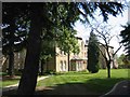
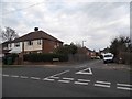
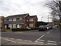
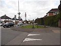
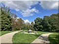
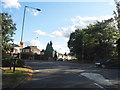
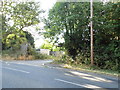
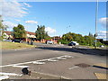
13 photos from this area
Area Information
Key information about the WD25 0BF including its size, population, and administrative classification.
- Area Type
- Postcode
- Area Size
- 4.7 hectares
- Population
- 2104
- Population Density
- 1343 people/km²
House Prices in WD25 0BF
59
Properties
£600,027
Average Sold Price
£210,000
Lowest Price
£797,000
Highest Price
Showing 59 properties
| Address | Type | Beds | Baths | Last Sale Price | Last Sale Date | |
|---|---|---|---|---|---|---|
| 34 Fraser Crescent, Abbots Langley, WD25 0BF | Semi-detached | 3 | 2 | £595,000 | Jul 2025 | |
| 17 Fraser Crescent, Abbots Langley, WD25 0BF | Terraced | 1 | 1 | £325,000 | Jul 2025 | |
| 24 Fraser Crescent, Abbots Langley, WD25 0BF | Semi-detached | 3 | 2 | £592,000 | Nov 2024 | |
| 42 Fraser Crescent, Abbots Langley, WD25 0BF | Detached | 4 | 2 | £750,000 | Nov 2024 | |
| 48 Fraser Crescent, Abbots Langley, WD25 0BF | house | - | - | £797,000 | Nov 2021 | |
| 55 Fraser Crescent, Abbots Langley, WD25 0BF | house | - | - | £210,000 | Dec 2018 | |
| 51 Fraser Crescent, Abbots Langley, WD25 0BF | house | - | - | £525,000 | Oct 2018 | |
| 53 Fraser Crescent, Abbots Langley, WD25 0BF | house | - | - | £525,000 | Sep 2018 | |
| 47 Fraser Crescent, Abbots Langley, WD25 0BF | Detached | 3 | 2 | £485,000 | Sep 2018 | |
| 49 Fraser Crescent, Abbots Langley, WD25 0BF | house | - | - | £480,000 | Aug 2018 |
Page 1 of 6
Energy Efficiency in WD25 0BF
Amenities
Schools
| Rank | School | Type | Entry gender | Ages |
|---|
Explore more schools in this area
Go to Schools tabDemographics
Household Size
Family (3-5 people)
most common
Accommodation Type
Houses
most common
Tenure
62
majority
Ethnic Group
White
most common
Religion
N/A
most common
Household Composition
N/A
most common
Age
47
median
Adults (30-64 years)
most common
Household Deprivation
N/A
with no deprivation
NS-SEC
41
in Lower managerial occupations
Explore more demographic insights in this area
Go to Demographics tabPlanning
Planning Constraints
- Flood RiskPremium
- Ramsar Wetland SitesPremium
- Area of Outstanding Natural BeautyPremium
- Protected Nature ReservePremium
- Protected WoodlandPremium