Area Overview for WD24 6NX
Photos of WD24 6NX
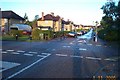
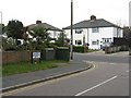

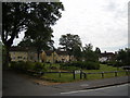
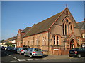
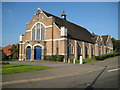
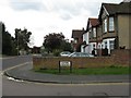
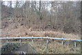
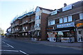
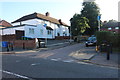
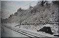
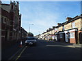
19 photos from this area
Area Information
Key information about the WD24 6NX including its size, population, and administrative classification.
- Area Type
- Postcode
- Area Size
- 9811 m²
- Population
- 1729
- Population Density
- 5360 people/km²
House Prices in WD24 6NX
25
Properties
£258,364
Average Sold Price
£125,000
Lowest Price
£465,000
Highest Price
Showing 25 properties
| Address | Type | Beds | Baths | Last Sale Price | Last Sale Date | |
|---|---|---|---|---|---|---|
| 181 The Harebreaks, Watford, WD24 6NX | house | - | - | £410,000 | Feb 2021 | |
| 175 The Harebreaks, Watford, WD24 6NX | Semi-detached | 3 | 1 | £465,000 | Jan 2018 | |
| 191A The Harebreaks, Watford, WD24 6NX | Flat | - | - | £240,000 | May 2016 | |
| 169 The Harebreaks, Watford, WD24 6NX | house | - | - | £280,000 | Jan 2015 | |
| 179 The Harebreaks, Watford, WD24 6NX | Terraced | 3 | 1 | £293,000 | Oct 2014 | |
| 183 The Harebreaks, Watford, WD24 6NX | house | - | - | £250,000 | Nov 2009 | |
| 203 The Harebreaks, Watford, WD24 6NX | house | - | - | £250,000 | Aug 2008 | |
| 191 The Harebreaks, Watford, WD24 6NX | Flat | 1 | 1 | £147,000 | Mar 2007 | |
| 185 The Harebreaks, Watford, WD24 6NX | Terraced | - | - | £230,000 | Sep 2006 | |
| 205 The Harebreaks, Watford, WD24 6NX | house | - | - | £152,000 | Aug 2003 |
Page 1 of 3
Energy Efficiency in WD24 6NX
Amenities
Schools
| Rank | School | Type | Entry gender | Ages |
|---|
Explore more schools in this area
Go to Schools tabDemographics
Household Size
Family (3-5 people)
most common
Accommodation Type
Houses
most common
Tenure
45
majority
Ethnic Group
White
most common
Religion
N/A
most common
Household Composition
N/A
most common
Age
47
median
Adults (30-64 years)
most common
Household Deprivation
N/A
with no deprivation
NS-SEC
25
in Lower managerial occupations
Explore more demographic insights in this area
Go to Demographics tabPlanning
Planning Constraints
- Flood RiskPremium
- Ramsar Wetland SitesPremium
- Area of Outstanding Natural BeautyPremium
- Protected Nature ReservePremium
- Protected WoodlandPremium