Area Overview for WD24 5JQ
Photos of WD24 5JQ
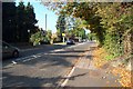
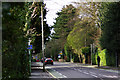
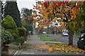
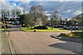
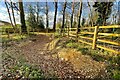
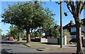
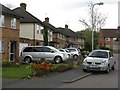

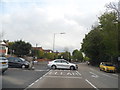
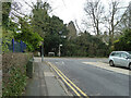
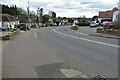
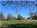
15 photos from this area
Area Information
Key information about the WD24 5JQ including its size, population, and administrative classification.
- Area Type
- Postcode
- Area Size
- 3.5 hectares
- Population
- 1892
- Population Density
- 6341 people/km²
House Prices in WD24 5JQ
57
Properties
£331,750
Average Sold Price
£72,000
Lowest Price
£625,000
Highest Price
Showing 57 properties
| Address | Type | Beds | Baths | Last Sale Price | Last Sale Date | |
|---|---|---|---|---|---|---|
| 7 Leaford Crescent, Watford, WD24 5JQ | Maisonette | 2 | 1 | £298,500 | Nov 2024 | |
| 9 Leaford Crescent, Watford, WD24 5JQ | Maisonette | 2 | 1 | £296,000 | Aug 2024 | |
| 37 Leaford Crescent, Watford, WD24 5JQ | house | 3 | 1 | £520,000 | Jan 2024 | |
| 27 Leaford Crescent, Watford, WD24 5JQ | Semi-detached | 3 | 1 | £615,000 | Dec 2023 | |
| 41 Leaford Crescent, Watford, WD24 5JQ | Semi-detached | 3 | 1 | £625,000 | Mar 2023 | |
| 65 Leaford Crescent, Watford, WD24 5JQ | Retail | 3 | 1 | £520,000 | Mar 2022 | |
| 61 Leaford Crescent, Watford, WD24 5JQ | Retail | 3 | - | £465,000 | Nov 2021 | |
| 55 Leaford Crescent, Watford, WD24 5JQ | house | 3 | - | £534,500 | Jun 2021 | |
| 95 Leaford Crescent, Watford, WD24 5JQ | Maisonette | 2 | 1 | £287,000 | Oct 2020 | |
| Llwyn, Leaford Crescent, Watford, WD24 5JQ | Detached | 4 | 1 | £425,000 | May 2019 |
Page 1 of 6
Energy Efficiency in WD24 5JQ
Amenities
Schools
| Rank | School | Type | Entry gender | Ages |
|---|
Explore more schools in this area
Go to Schools tabDemographics
Household Size
Family (3-5 people)
most common
Accommodation Type
Houses
most common
Tenure
54
majority
Ethnic Group
White
most common
Religion
N/A
most common
Household Composition
N/A
most common
Age
47
median
Adults (30-64 years)
most common
Household Deprivation
N/A
with no deprivation
NS-SEC
32
in Lower managerial occupations
Explore more demographic insights in this area
Go to Demographics tabPlanning
Planning Constraints
- Flood RiskPremium
- Ramsar Wetland SitesPremium
- Area of Outstanding Natural BeautyPremium
- Protected Nature ReservePremium
- Protected WoodlandPremium