Area Overview for WD23 2JE
Photos of WD23 2JE
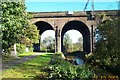
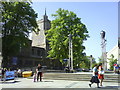
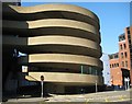
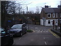
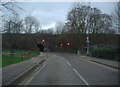
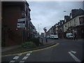


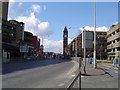
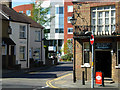
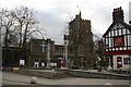
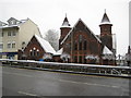
100 photos from this area
Area Information
Key information about the WD23 2JE including its size, population, and administrative classification.
- Area Type
- Postcode
- Area Size
- 3901 m²
- Population
- 1753
- Population Density
- 2687 people/km²
House Prices in WD23 2JE
18
Properties
£315,085
Average Sold Price
£118,000
Lowest Price
£580,000
Highest Price
Showing 18 properties
| Address | Type | Beds | Baths | Last Sale Price | Last Sale Date | |
|---|---|---|---|---|---|---|
| 14 Walton Road, Bushey, WD23 2JE | Terraced | 2 | 1 | £570,000 | Jul 2024 | |
| 16 Walton Road, Bushey, WD23 2JE | Terraced | 4 | 2 | £580,000 | Feb 2022 | |
| 20 Walton Road, Bushey, WD23 2JE | Terraced | 1 | 1 | £465,000 | Mar 2021 | |
| 12 Walton Road, Bushey, WD23 2JE | Terraced | 3 | - | £465,000 | Mar 2021 | |
| 26 Walton Road, Bushey, WD23 2JE | Terraced | 4 | 2 | £520,000 | Oct 2017 | |
| 24 Walton Road, Bushey, WD23 2JE | Terraced | 3 | 1 | £462,250 | Jul 2017 | |
| 19 Walton Road, Bushey, WD23 2JE | Semi-detached | 3 | 1 | £252,025 | Jun 2017 | |
| 30A Walton Road, Bushey, WD23 2JE | Semi-detached | 2 | 1 | £205,000 | Mar 2011 | |
| 30 Walton Road, Bushey, WD23 2JE | house | - | - | £182,000 | Dec 2009 | |
| 17 Walton Road, Bushey, WD23 2JE | house | 2 | 1 | £218,000 | Feb 2006 |
Page 1 of 2
Energy Efficiency in WD23 2JE
Amenities
Schools
| Rank | School | Type | Entry gender | Ages |
|---|
Explore more schools in this area
Go to Schools tabDemographics
Household Size
Family (3-5 people)
most common
Accommodation Type
Houses
most common
Tenure
59
majority
Ethnic Group
White
most common
Religion
N/A
most common
Household Composition
N/A
most common
Age
47
median
Adults (30-64 years)
most common
Household Deprivation
N/A
with no deprivation
NS-SEC
37
in Lower managerial occupations
Explore more demographic insights in this area
Go to Demographics tabPlanning
Planning Constraints
- Flood RiskPremium
- Ramsar Wetland SitesPremium
- Area of Outstanding Natural BeautyPremium
- Protected Nature ReservePremium
- Protected WoodlandPremium