Area Overview for WD23 1NZ
Photos of WD23 1NZ
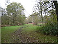
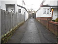
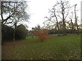
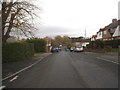
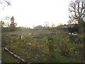
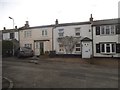
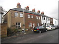
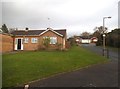
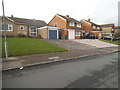
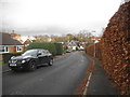
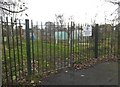
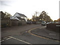
46 photos from this area
Area Information
Key information about the WD23 1NZ including its size, population, and administrative classification.
- Area Type
- Postcode
- Area Size
- 1.6 hectares
- Population
- 1552
- Population Density
- 658 people/km²
House Prices in WD23 1NZ
28
Properties
£502,892
Average Sold Price
£111,500
Lowest Price
£1,215,000
Highest Price
Showing 28 properties
| Address | Type | Beds | Baths | Last Sale Price | Last Sale Date | |
|---|---|---|---|---|---|---|
| Pinelands, Clay Lane, Bushey Heath, WD23 1NZ | Detached | 4 | 4 | £1,215,000 | Nov 2023 | |
| 35 Clay Lane, Bushey Heath, WD23 1NZ | Detached | 4 | 1 | £690,000 | Apr 2019 | |
| 11 Clay Lane, Bushey Heath, WD23 1NZ | house | 4 | 2 | £680,000 | Aug 2017 | |
| 19 Clay Lane, Bushey Heath, WD23 1NZ | Semi-detached | 3 | 1 | £490,000 | Jul 2015 | |
| 29 Clay Lane, Bushey Heath, WD23 1NZ | Detached | 3 | 1 | £437,000 | Apr 2015 | |
| 33 Clay Lane, Bushey Heath, WD23 1NZ | Detached | 4 | 1 | £640,000 | Jan 2014 | |
| Anacapri, Clay Lane, Bushey Heath, WD23 1NZ | house | - | - | £730,000 | May 2011 | |
| Greystone, Clay Lane, Bushey Heath, WD23 1NZ | Detached | - | - | £860,000 | Dec 2009 | |
| 25 Clay Lane, Bushey Heath, WD23 1NZ | Semi-detached | - | - | £385,000 | Sep 2007 | |
| 9 Clay Lane, Bushey Heath, WD23 1NZ | house | - | - | £375,000 | May 2007 |
Page 1 of 3
Energy Efficiency in WD23 1NZ
Amenities
Schools
| Rank | School | Type | Entry gender | Ages |
|---|
Explore more schools in this area
Go to Schools tabDemographics
Household Size
Family (3-5 people)
most common
Accommodation Type
Houses
most common
Tenure
94
majority
Ethnic Group
White
most common
Religion
N/A
most common
Household Composition
N/A
most common
Age
47
median
Adults (30-64 years)
most common
Household Deprivation
N/A
with no deprivation
NS-SEC
49
in Lower managerial occupations
Explore more demographic insights in this area
Go to Demographics tabPlanning
Planning Constraints
- Flood RiskPremium
- Ramsar Wetland SitesPremium
- Area of Outstanding Natural BeautyPremium
- Protected Nature ReservePremium
- Protected WoodlandPremium