Area Overview for WD19 5ES
Photos of WD19 5ES
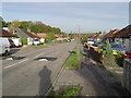
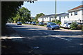


39 photos from this area
Area Information
Key information about the WD19 5ES including its size, population, and administrative classification.
- Area Type
- Postcode
- Area Size
- 9893 m²
- Population
- 1848
- Population Density
- 3329 people/km²
House Prices in WD19 5ES
21
Properties
£333,103
Average Sold Price
£133,500
Lowest Price
£575,000
Highest Price
Showing 21 properties
| Address | Type | Beds | Baths | Last Sale Price | Last Sale Date | |
|---|---|---|---|---|---|---|
| 108 Harrow Way, Carpenders Park, WD19 5ES | Bungalow | 2 | 1 | £438,500 | Aug 2024 | |
| 138 Harrow Way, Carpenders Park, WD19 5ES | Bungalow | - | - | £490,000 | Mar 2023 | |
| 128 Harrow Way, Carpenders Park, WD19 5ES | Bungalow | - | - | £575,000 | May 2021 | |
| 104 Harrow Way, Carpenders Park, WD19 5ES | Semi-detached | 2 | - | £420,000 | May 2020 | |
| 142 Harrow Way, Carpenders Park, WD19 5ES | Bungalow | - | - | £491,000 | May 2020 | |
| 118 Harrow Way, Carpenders Park, WD19 5ES | Bungalow | 2 | 1 | £426,000 | Nov 2019 | |
| 130 Harrow Way, Carpenders Park, WD19 5ES | Bungalow | - | - | £435,000 | Oct 2019 | |
| 144 Harrow Way, Carpenders Park, WD19 5ES | Bungalow | - | - | £523,000 | Feb 2018 | |
| 106 Harrow Way, Carpenders Park, WD19 5ES | Semi-detached | 3 | 2 | £475,000 | Feb 2016 | |
| 136 Harrow Way, Carpenders Park, WD19 5ES | Bungalow | - | - | £465,000 | Mar 2015 |
Page 1 of 3
Energy Efficiency in WD19 5ES
Amenities
Schools
| Rank | School | Type | Entry gender | Ages |
|---|
Explore more schools in this area
Go to Schools tabDemographics
Household Size
Family (3-5 people)
most common
Accommodation Type
Houses
most common
Tenure
76
majority
Ethnic Group
White
most common
Religion
N/A
most common
Household Composition
N/A
most common
Age
47
median
Adults (30-64 years)
most common
Household Deprivation
N/A
with no deprivation
NS-SEC
34
in Lower managerial occupations
Explore more demographic insights in this area
Go to Demographics tabPlanning
Planning Constraints
- Flood RiskPremium
- Ramsar Wetland SitesPremium
- Area of Outstanding Natural BeautyPremium
- Protected Nature ReservePremium
- Protected WoodlandPremium