Area Overview for WD19 5BN
Photos of WD19 5BN
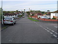
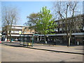
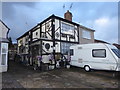
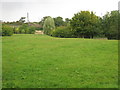
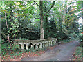
26 photos from this area
Area Information
Key information about the WD19 5BN including its size, population, and administrative classification.
- Area Type
- Postcode
- Area Size
- 1.3 hectares
- Population
- 1503
- Population Density
- 2284 people/km²
House Prices in WD19 5BN
30
Properties
£386,690
Average Sold Price
£84,000
Lowest Price
£650,000
Highest Price
Showing 30 properties
| Address | Type | Beds | Baths | Last Sale Price | Last Sale Date | |
|---|---|---|---|---|---|---|
| 149 Carpenders Avenue, Carpenders Park, WD19 5BN | house | - | - | £590,000 | Aug 2024 | |
| 111 Carpenders Avenue, Carpenders Park, WD19 5BN | Bungalow | - | - | £500,000 | Sep 2022 | |
| 131 Carpenders Avenue, Carpenders Park, WD19 5BN | Semi-detached | 2 | 2 | £600,000 | Jul 2022 | |
| 95 Carpenders Avenue, Carpenders Park, WD19 5BN | Bungalow | 2 | - | £525,000 | Jun 2022 | |
| 133 Carpenders Avenue, Carpenders Park, WD19 5BN | Retail | 1 | 1 | £450,000 | Apr 2022 | |
| 125 Carpenders Avenue, Carpenders Park, WD19 5BN | Bungalow | 4 | 2 | £650,000 | Mar 2022 | |
| 127 Carpenders Avenue, Carpenders Park, WD19 5BN | Bungalow | - | - | £445,000 | Jan 2020 | |
| 97 Carpenders Avenue, Carpenders Park, WD19 5BN | Bungalow | - | - | £547,500 | Jun 2016 | |
| 99 Carpenders Avenue, Carpenders Park, WD19 5BN | Bungalow | - | - | £520,000 | Apr 2016 | |
| 113 Carpenders Avenue, Carpenders Park, WD19 5BN | Bungalow | - | - | £529,380 | May 2015 |
Page 1 of 3
Energy Efficiency in WD19 5BN
Amenities
Schools
| Rank | School | Type | Entry gender | Ages |
|---|
Explore more schools in this area
Go to Schools tabDemographics
Household Size
Family (3-5 people)
most common
Accommodation Type
Houses
most common
Tenure
83
majority
Ethnic Group
White
most common
Religion
N/A
most common
Household Composition
N/A
most common
Age
47
median
Adults (30-64 years)
most common
Household Deprivation
N/A
with no deprivation
NS-SEC
40
in Lower managerial occupations
Explore more demographic insights in this area
Go to Demographics tabPlanning
Planning Constraints
- Flood RiskPremium
- Ramsar Wetland SitesPremium
- Area of Outstanding Natural BeautyPremium
- Protected Nature ReservePremium
- Protected WoodlandPremium