Area Overview for WD19 4TR
Photos of WD19 4TR
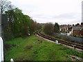
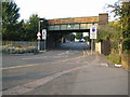
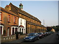
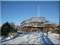
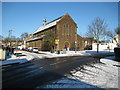
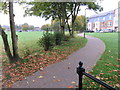
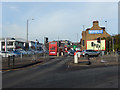


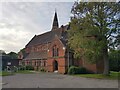

68 photos from this area
Area Information
Key information about the WD19 4TR including its size, population, and administrative classification.
- Area Type
- Postcode
- Area Size
- 1.2 hectares
- Population
- 1773
- Population Density
- 4175 people/km²
House Prices in WD19 4TR
34
Properties
£647,886
Average Sold Price
£128,000
Lowest Price
£1,150,000
Highest Price
Showing 34 properties
| Address | Type | Beds | Baths | Last Sale Price | Last Sale Date | |
|---|---|---|---|---|---|---|
| 72 Kingsfield Road, Watford, WD19 4TR | Semi-detached | 4 | 2 | £1,150,000 | Dec 2024 | |
| 54 Kingsfield Road, Watford, WD19 4TR | house | - | - | £995,000 | Jun 2021 | |
| 46 Kingsfield Road, Watford, WD19 4TR | house | - | - | £900,000 | Mar 2021 | |
| 50 Kingsfield Road, Watford, WD19 4TR | Semi-detached | 4 | 2 | £865,000 | Nov 2019 | |
| 70 Kingsfield Road, Watford, WD19 4TR | Semi-detached | 5 | 2 | £860,000 | Dec 2018 | |
| 14A Kingsfield Road, Watford, WD19 4TR | Maisonette | 1 | 1 | £625,000 | Mar 2016 | |
| 56 Kingsfield Road, Watford, WD19 4TR | Flat | 1 | - | £790,000 | Jul 2015 | |
| 58 Kingsfield Road, Watford, WD19 4TR | Semi-detached | 5 | 3 | £680,000 | Feb 2015 | |
| 74 Kingsfield Road, Watford, WD19 4TR | house | 4 | - | £580,000 | Feb 2011 | |
| 62 Kingsfield Road, Watford, WD19 4TR | Terraced | - | - | £640,000 | Apr 2008 |
Page 1 of 4
Energy Efficiency in WD19 4TR
Amenities
Schools
| Rank | School | Type | Entry gender | Ages |
|---|
Explore more schools in this area
Go to Schools tabDemographics
Household Size
Family (3-5 people)
most common
Accommodation Type
Houses
most common
Tenure
80
majority
Ethnic Group
White
most common
Religion
N/A
most common
Household Composition
N/A
most common
Age
47
median
Adults (30-64 years)
most common
Household Deprivation
N/A
with no deprivation
NS-SEC
50
in Lower managerial occupations
Explore more demographic insights in this area
Go to Demographics tabPlanning
Planning Constraints
- Flood RiskPremium
- Ramsar Wetland SitesPremium
- Area of Outstanding Natural BeautyPremium
- Protected Nature ReservePremium
- Protected WoodlandPremium