Area Overview for WD19 4NZ
Photos of WD19 4NZ


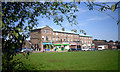
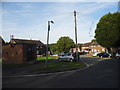
27 photos from this area
Area Information
Key information about the WD19 4NZ including its size, population, and administrative classification.
- Area Type
- Postcode
- Area Size
- 7.5 hectares
- Population
- 1848
- Population Density
- 1116 people/km²
House Prices in WD19 4NZ
45
Properties
£499,531
Average Sold Price
£160,000
Lowest Price
£820,000
Highest Price
Showing 45 properties
| Address | Type | Beds | Baths | Last Sale Price | Last Sale Date | |
|---|---|---|---|---|---|---|
| 126 Hillcroft Crescent, Oxhey Hall, WD19 4NZ | Detached | 3 | 2 | £805,000 | Sep 2021 | |
| 96 Hillcroft Crescent, Oxhey Hall, WD19 4NZ | house | 3 | 1 | £820,000 | Jul 2021 | |
| 166 Hillcroft Crescent, Oxhey Hall, WD19 4NZ | Detached | 3 | 2 | £650,000 | Nov 2020 | |
| 142 Hillcroft Crescent, Oxhey Hall, WD19 4NZ | Semi-detached | 3 | 1 | £677,000 | Apr 2020 | |
| 134 Hillcroft Crescent, Oxhey Hall, WD19 4NZ | Semi-detached | 3 | 1 | £687,000 | Nov 2019 | |
| 106 Hillcroft Crescent, Oxhey Hall, WD19 4NZ | Semi-detached | 3 | 1 | £622,050 | Oct 2019 | |
| 124 Hillcroft Crescent, Oxhey Hall, WD19 4NZ | Detached | 3 | 1 | £665,000 | Sep 2019 | |
| 112 Hillcroft Crescent, Oxhey Hall, WD19 4NZ | Semi-detached | 3 | 1 | £595,000 | Jul 2019 | |
| 138 Hillcroft Crescent, Oxhey Hall, WD19 4NZ | Semi-detached | 3 | 1 | £660,000 | Mar 2019 | |
| 152 Hillcroft Crescent, Oxhey Hall, WD19 4NZ | Semi-detached | 4 | 2 | £648,000 | Mar 2017 |
Page 1 of 5
Energy Efficiency in WD19 4NZ
Amenities
Schools
| Rank | School | Type | Entry gender | Ages |
|---|
Explore more schools in this area
Go to Schools tabDemographics
Household Size
Family (3-5 people)
most common
Accommodation Type
Houses
most common
Tenure
67
majority
Ethnic Group
White
most common
Religion
N/A
most common
Household Composition
N/A
most common
Age
47
median
Adults (30-64 years)
most common
Household Deprivation
N/A
with no deprivation
NS-SEC
39
in Lower managerial occupations
Explore more demographic insights in this area
Go to Demographics tabPlanning
Planning Constraints
- Flood RiskPremium
- Ramsar Wetland SitesPremium
- Area of Outstanding Natural BeautyPremium
- Protected Nature ReservePremium
- Protected WoodlandPremium