Area Overview for WD19 4DE
Photos of WD19 4DE


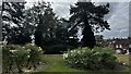
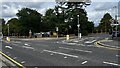
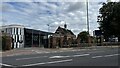
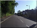
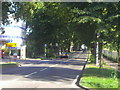
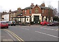
28 photos from this area
Area Information
Key information about the WD19 4DE including its size, population, and administrative classification.
- Area Type
- Postcode
- Area Size
- 7111 m²
- Population
- 1664
- Population Density
- 2710 people/km²
House Prices in WD19 4DE
18
Properties
£468,035
Average Sold Price
£229,950
Lowest Price
£665,000
Highest Price
Showing 18 properties
| Address | Type | Beds | Baths | Last Sale Price | Last Sale Date | |
|---|---|---|---|---|---|---|
| 11 Haydon Road, Watford, WD19 4DE | Terraced | 3 | 1 | £665,000 | May 2023 | |
| 13 Haydon Road, Watford, WD19 4DE | Terraced | 3 | 1 | £512,000 | Jan 2020 | |
| 27 Haydon Road, Watford, WD19 4DE | Terraced | 3 | 1 | £578,000 | Jul 2019 | |
| 3 Haydon Road, Watford, WD19 4DE | Terraced | 4 | 2 | £595,000 | Jun 2019 | |
| 25 Haydon Road, Watford, WD19 4DE | Terraced | 3 | 1 | £512,000 | Sep 2017 | |
| 31 Haydon Road, Watford, WD19 4DE | Detached | 3 | 1 | £620,000 | Apr 2016 | |
| 19 Haydon Road, Watford, WD19 4DE | house | 3 | - | £487,500 | Sep 2015 | |
| 21 Haydon Road, Watford, WD19 4DE | Terraced | 3 | - | £435,000 | Dec 2014 | |
| 9 Haydon Road, Watford, WD19 4DE | Terraced | 3 | 1 | £400,000 | May 2014 | |
| 37 Haydon Road, Watford, WD19 4DE | Maisonette | - | - | £455,000 | Oct 2012 |
Page 1 of 2
Energy Efficiency in WD19 4DE
Amenities
Schools
| Rank | School | Type | Entry gender | Ages |
|---|
Explore more schools in this area
Go to Schools tabDemographics
Household Size
Two person
most common
Accommodation Type
Houses
most common
Tenure
78
majority
Ethnic Group
White
most common
Religion
N/A
most common
Household Composition
N/A
most common
Age
47
median
Adults (30-64 years)
most common
Household Deprivation
N/A
with no deprivation
NS-SEC
52
in Lower managerial occupations
Explore more demographic insights in this area
Go to Demographics tabPlanning
Planning Constraints
- Flood RiskPremium
- Ramsar Wetland SitesPremium
- Area of Outstanding Natural BeautyPremium
- Protected Nature ReservePremium
- Protected WoodlandPremium