Area Overview for WD18 7QD
Photos of WD18 7QD
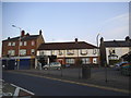
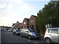
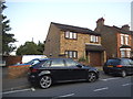
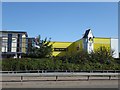
52 photos from this area
Area Information
Key information about the WD18 7QD including its size, population, and administrative classification.
- Area Type
- Postcode
- Area Size
- 1.4 hectares
- Population
- 1833
- Population Density
- 14343 people/km²
House Prices in WD18 7QD
43
Properties
£283,593
Average Sold Price
£74,000
Lowest Price
£620,000
Highest Price
Showing 43 properties
| Address | Type | Beds | Baths | Last Sale Price | Last Sale Date | |
|---|---|---|---|---|---|---|
| 72 King Georges Avenue, Watford, WD18 7QD | Maisonette | 1 | 1 | £300,000 | Dec 2024 | |
| 72A King Georges Avenue, Watford, WD18 7QD | Maisonette | 1 | 1 | £240,000 | Jun 2024 | |
| 18 King Georges Avenue, Watford, WD18 7QD | Semi-detached | 3 | 1 | £500,000 | Oct 2023 | |
| 36 King Georges Avenue, Watford, WD18 7QD | house | 3 | 2 | £620,000 | May 2022 | |
| 70 King Georges Avenue, Watford, WD18 7QD | Semi-detached | 3 | 1 | £450,000 | Sep 2021 | |
| 64 King Georges Avenue, Watford, WD18 7QD | house | 3 | - | £465,000 | Jul 2017 | |
| 26 King Georges Avenue, Watford, WD18 7QD | Semi-detached | 3 | - | £515,000 | Dec 2016 | |
| 6 King Georges Avenue, Watford, WD18 7QD | house | - | - | £268,000 | Nov 2016 | |
| 56 King Georges Avenue, Watford, WD18 7QD | Semi-detached | 3 | 1 | £353,000 | Apr 2015 | |
| 76 King Georges Avenue, Watford, WD18 7QD | Semi-detached | 3 | 1 | £370,000 | Dec 2014 |
Page 1 of 5
Energy Efficiency in WD18 7QD
Amenities
Schools
| Rank | School | Type | Entry gender | Ages |
|---|
Explore more schools in this area
Go to Schools tabDemographics
Household Size
Family (3-5 people)
most common
Accommodation Type
Flats
most common
Tenure
35
majority
Ethnic Group
White
most common
Religion
N/A
most common
Household Composition
N/A
most common
Age
47
median
Adults (30-64 years)
most common
Household Deprivation
N/A
with no deprivation
NS-SEC
33
in Lower managerial occupations
Explore more demographic insights in this area
Go to Demographics tabPlanning
Planning Constraints
- Flood RiskPremium
- Ramsar Wetland SitesPremium
- Area of Outstanding Natural BeautyPremium
- Protected Nature ReservePremium
- Protected WoodlandPremium