Area Overview for WD18 6XL
Photos of WD18 6XL
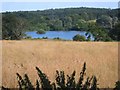
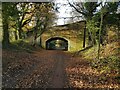
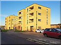
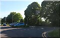
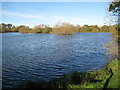
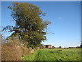
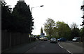
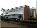
42 photos from this area
Area Information
Key information about the WD18 6XL including its size, population, and administrative classification.
- Area Type
- Postcode
- Area Size
- 1.3 hectares
- Population
- Not available
- Population Density
- Not available
House Prices in WD18 6XL
55
Properties
£104,000
Average Sold Price
£60,000
Lowest Price
£172,000
Highest Price
Showing 55 properties
| Address | Type | Beds | Baths | Last Sale Price | Last Sale Date | |
|---|---|---|---|---|---|---|
| 5 Latimer Close, Watford, WD18 6XL | Terraced | 2 | 1 | £172,000 | Mar 2003 | |
| 2 Latimer Close, Watford, WD18 6XL | Terraced | - | - | £80,000 | Mar 1999 | |
| 3 Latimer Close, Watford, WD18 6XL | Terraced | - | - | £60,000 | Nov 1995 | |
| 52 Latimer Close, Watford, WD18 6XL | Terraced | - | - | - | - | |
| 51 Latimer Close, Watford, WD18 6XL | Terraced | - | - | - | - | |
| 8 Latimer Close, Watford, WD18 6XL | Terraced | - | - | - | - | |
| 20 Latimer Close, Watford, WD18 6XL | Maisonette | - | - | - | - | |
| 13 Latimer Close, Watford, WD18 6XL | Flat | - | - | - | - | |
| 23 Latimer Close, Watford, WD18 6XL | Flat | - | - | - | - | |
| 6 Latimer Close, Watford, WD18 6XL | Terraced | - | - | - | - |
Page 1 of 6
Energy Efficiency in WD18 6XL
Amenities
Schools
| Rank | School | Type | Entry gender | Ages |
|---|
Explore more schools in this area
Go to Schools tabDemographics
Household Size
Family (3-5 people)
most common
Accommodation Type
Flats
most common
Tenure
32
majority
Ethnic Group
White
most common
Religion
N/A
most common
Household Composition
N/A
most common
Age
47
median
Adults (30-64 years)
most common
Household Deprivation
N/A
with no deprivation
NS-SEC
24
in Lower managerial occupations
Explore more demographic insights in this area
Go to Demographics tabPlanning
Planning Constraints
- Flood RiskPremium
- Ramsar Wetland SitesPremium
- Area of Outstanding Natural BeautyPremium
- Protected Nature ReservePremium
- Protected WoodlandPremium