Area Overview for WD18 0WB
Photos of WD18 0WB
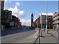
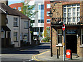
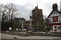
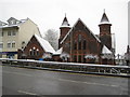
100 photos from this area
Area Information
Key information about the WD18 0WB including its size, population, and administrative classification.
- Area Type
- Postcode
- Area Size
- 3909 m²
- Population
- 2664
- Population Density
- 4487 people/km²
House Prices in WD18 0WB
9
Properties
£254,100
Average Sold Price
£99,950
Lowest Price
£400,000
Highest Price
Showing 9 properties
| Address | Type | Beds | Baths | Last Sale Price | Last Sale Date | |
|---|---|---|---|---|---|---|
| 39 Kings Close, Watford, WD18 0WB | Terraced | 2 | 2 | £400,000 | Mar 2016 | |
| 47 Kings Close, Watford, WD18 0WB | Terraced | 3 | 2 | £390,000 | Jun 2014 | |
| 45 Kings Close, Watford, WD18 0WB | house | 2 | - | £242,000 | Sep 2011 | |
| 31 Kings Close, Watford, WD18 0WB | Detached | 3 | 2 | £275,000 | May 2010 | |
| 41 Kings Close, Watford, WD18 0WB | Terraced | - | - | £250,000 | Dec 2007 | |
| 33 Kings Close, Watford, WD18 0WB | Terraced | 3 | 2 | £245,000 | Sep 2006 | |
| 37 Kings Close, Watford, WD18 0WB | Terraced | - | - | £199,950 | Dec 2003 | |
| 35 Kings Close, Watford, WD18 0WB | Terraced | - | - | £185,000 | Aug 2002 | |
| 43 Kings Close, Watford, WD18 0WB | Terraced | - | - | £99,950 | Dec 1996 |
Energy Efficiency in WD18 0WB
Amenities
Schools
| Rank | School | Type | Entry gender | Ages |
|---|
Explore more schools in this area
Go to Schools tabDemographics
Household Size
One person
most common
Accommodation Type
Houses
most common
Tenure
45
majority
Ethnic Group
White
most common
Religion
N/A
most common
Household Composition
N/A
most common
Age
47
median
Adults (30-64 years)
most common
Household Deprivation
N/A
with no deprivation
NS-SEC
38
in Lower managerial occupations
Explore more demographic insights in this area
Go to Demographics tabPlanning
Planning Constraints
- Flood RiskPremium
- Ramsar Wetland SitesPremium
- Area of Outstanding Natural BeautyPremium
- Protected Nature ReservePremium
- Protected WoodlandPremium