Area Overview for WD18 0EA
Photos of WD18 0EA


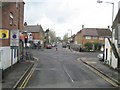

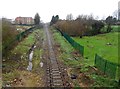


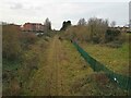


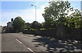
41 photos from this area
Area Information
Key information about the WD18 0EA including its size, population, and administrative classification.
- Area Type
- Postcode
- Area Size
- 3865 m²
- Population
- 1742
- Population Density
- 4442 people/km²
House Prices in WD18 0EA
31
Properties
£215,600
Average Sold Price
£36,500
Lowest Price
£445,000
Highest Price
Showing 31 properties
| Address | Type | Beds | Baths | Last Sale Price | Last Sale Date | |
|---|---|---|---|---|---|---|
| 4 St James Road, Watford, WD18 0EA | house | - | - | £445,000 | Aug 2022 | |
| 28 St James Road, Watford, WD18 0EA | house | - | - | £359,700 | Mar 2015 | |
| 36A St James Road, Watford, WD18 0EA | house | - | - | £172,000 | Dec 2014 | |
| 26 St James Road, Watford, WD18 0EA | Terraced | 3 | - | £230,000 | Nov 2013 | |
| 36 St James Road, Watford, WD18 0EA | house | - | - | £280,000 | Apr 2013 | |
| 8 St James Road, Watford, WD18 0EA | Terraced | - | - | £248,000 | Apr 2008 | |
| 22 St James Road, Watford, WD18 0EA | house | - | - | £165,000 | Nov 2006 | |
| 30 St James Road, Watford, WD18 0EA | Retail | 4 | 2 | £220,000 | May 2005 | |
| 12 St James Road, Watford, WD18 0EA | Terraced | - | - | £220,000 | Jan 2004 | |
| 18 St James Road, Watford, WD18 0EA | house | - | - | £101,000 | Dec 1999 |
Page 1 of 4
Energy Efficiency in WD18 0EA
Amenities
Schools
| Rank | School | Type | Entry gender | Ages |
|---|
Explore more schools in this area
Go to Schools tabDemographics
Household Size
Family (3-5 people)
most common
Accommodation Type
Houses
most common
Tenure
47
majority
Ethnic Group
White
most common
Religion
N/A
most common
Household Composition
N/A
most common
Age
47
median
Adults (30-64 years)
most common
Household Deprivation
N/A
with no deprivation
NS-SEC
37
in Lower managerial occupations
Explore more demographic insights in this area
Go to Demographics tabPlanning
Planning Constraints
- Flood RiskPremium
- Ramsar Wetland SitesPremium
- Area of Outstanding Natural BeautyPremium
- Protected Nature ReservePremium
- Protected WoodlandPremium